Skip the north peak. Unless you arrive in Yerevan with crampons, an ice axe, and at least one mountain you’ve already done above 4,000 metres on your CV, the highest of Aragats’s four summits is not what you came for. The southern peak is. And actually, you came for a whole day on the mountain. The medieval fortress on its flank, the lake at 3,200 metres, the alphabet sculpture park, the cold-war-era radio telescope, not just a checkbox at the top.
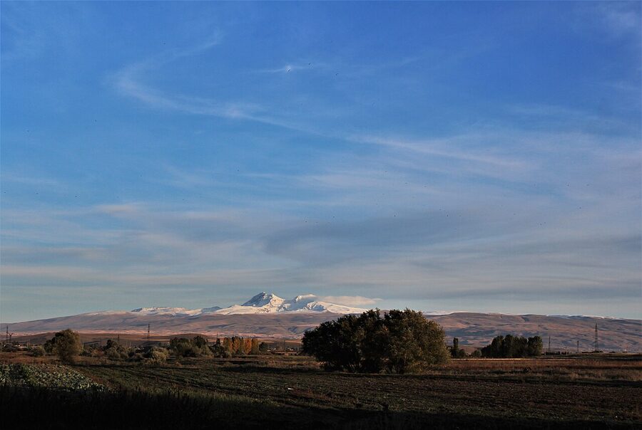
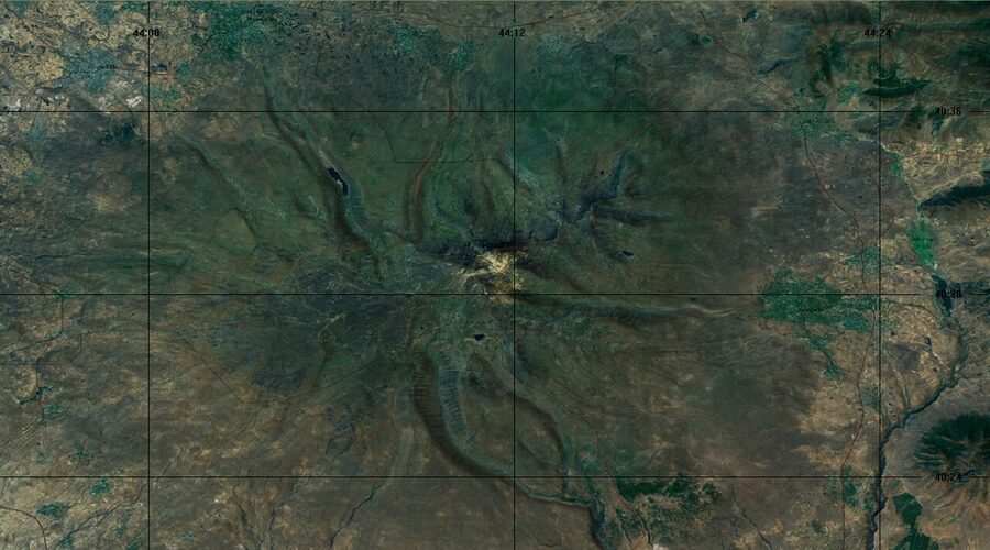
That’s the call this guide makes and defends. Aragats works as a single big day out from Yerevan, not as a summit-bagging mission. The four-peak volcanic massif sits about 40 km northwest of the capital, takes up roughly a fifth of the country’s surface area, and has more interesting things on its slopes than on its peaks. If you only have one day for it, treat the southern summit as the cherry, not the cake.
In This Article
- The four peaks at a glance
- Southern peak (3,888 m)
- Western peak (3,995 m)
- Eastern peak (3,908 m)
- Northern peak (4,090 m)
- Lake Kari: the trailhead and the end of the road
- The Aragats Cosmic Ray Research Station
- The hotel and restaurant at Kari
- Amberd Fortress and Vahramashen Church
- The Vahramashen Church next door
- The Alphabet Park
- Byurakan Observatory and the ROT-54 radio telescope
- The ROT-54 telescope at Orgov
- Getting there from Yerevan
- Renting a car
- Hiring a driver via GoTrip
- Joining an organised tour
- Public transport (with caveats)
- When to go
- The afternoon storm pattern
- What to pack
- How Aragats fits into a wider Armenia trip
- One more thing about the mountain itself
- The southern peak verdict, restated
The four peaks at a glance
Aragats is one mountain in name only. It’s a stratovolcano with four named summits along the rim of a wide, eroded caldera, and they vary wildly in difficulty. The names follow the cardinal directions, which is both prosaic and useful. Once you’re up there with weather closing in, “south” and “north” beat any of the older Armenian names for navigation.
| Peak | Elevation | Difficulty | Time from Lake Kari | Best for |
|---|---|---|---|---|
| Southern | 3,888 m | Moderate hike, non-technical | 5 to 6 hours round trip | The default day-tripper choice |
| Western | 3,995 m | Hard, scrambling | 7 to 8 hours round trip | Fit hikers wanting more than the south |
| Eastern | 3,908 m | Hard, exposed scrambling | 7 to 9 hours round trip | Less travelled, route-finding skill required |
| Northern | 4,090 m | Class 4 scrambling, snowfields, mountaineering | 10+ hours round trip or two-day trek | Experienced mountaineers only |
Treat the table as the short answer if you’re skim-reading. The body unpacks each peak below.
Southern peak (3,888 m)
This is the one to do. You start from Lake Kari at 3,200 m, which means you only have about 700 m of vertical to gain. The trail loops behind the small hotel complex, follows a jeep track up an open meadow, picks up a defined footpath past a couple of rocky patches around the 3 km mark, and then switchbacks up to the saddle between the southern and western peaks. From the saddle it’s another 200 m or so south to the summit cairn. The whole thing is about 5 km long, takes 2.5 to 3 hours up and another two to come back, and never gets harder than walking on uneven scree.
It is also the busiest peak. On a clear July weekend you’ll meet Armenian hikers, the occasional Russian tour group, and at least one French or German pair. That’s part of the appeal. If something goes sideways with weather or a turned ankle you are not alone up there. If you’ve come to Armenia mainly for the monasteries (Garni, Geghard, Khor Virap) and you want one mountain day on the trip, this is it.
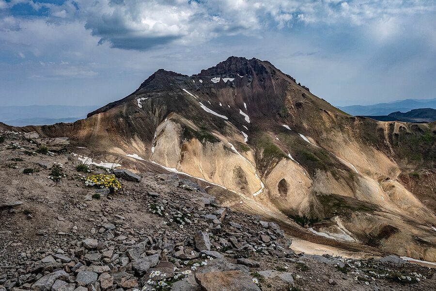
Western peak (3,995 m)
The west adds about 100 m of elevation to the south, but the difficulty jump is bigger than that suggests. From the saddle you keep going west instead of south, and the route turns into class 3 scrambling along the caldera rim. Most fit hikers can do it without ropes, but you’re using your hands, and you do not want to be on this section in rain or hail. Both of which arrive without warning from late morning onward. Allow 7 to 8 hours for the round trip from Kari and start at 6 a.m. or earlier.
Eastern peak (3,908 m)
The east is the quietest peak. Most parties skip it because it requires either dropping into the caldera and crossing it (a long, scree-heavy traverse) or following the rim around in the opposite direction from the west. Route-finding is the real challenge: there are no signs and the trail braids in places. If you’re going east, go with someone who’s done it before, and bring a GPS track loaded onto your phone before you lose signal. Wikiloc has good tracks for the south and north peaks but the east is thinner; double-check before relying on a single source.
Northern peak (4,090 m)
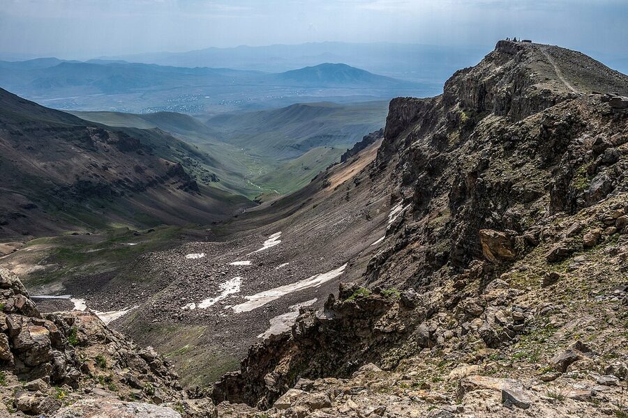
The country high point. And the one that will hurt you if you treat it like a hike. The standard route from Kari Lake goes up the western edge of the caldera, drops down into it, crosses snow patches that linger into August, climbs to a false summit, then traverses a knife-edge ridge with serious exposure on both sides. The last section is class 4 scrambling. At the narrowest point you balance across about a foot of rock with no handholds and a long fall on either side.
You need crampons and an ice axe even in summer because of the snowfields inside the caldera. You should be moving by 4 a.m. to be off the ridge before afternoon storms. Most people who summit the north either go with a guide or join one of the organised expeditions that run from Yerevan a few times each season. If you’ve climbed any of the Caucasus 4,000+ peaks before, you know what this kind of day looks like. If you haven’t, the south peak is genuinely a more rewarding day for someone who’s there to be on a mountain rather than to bag a number.
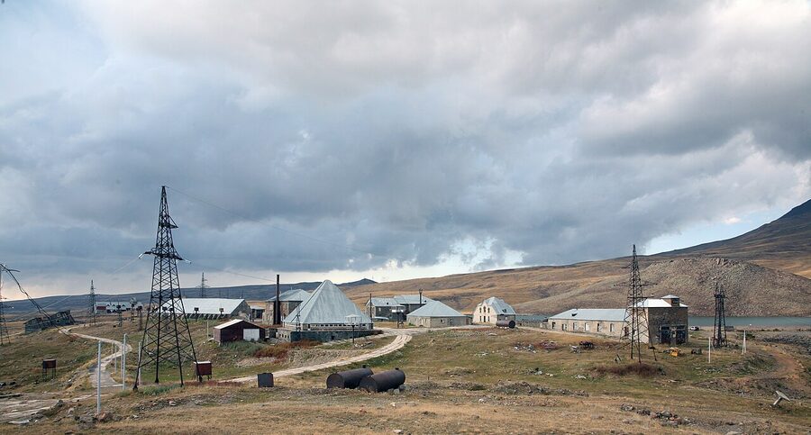
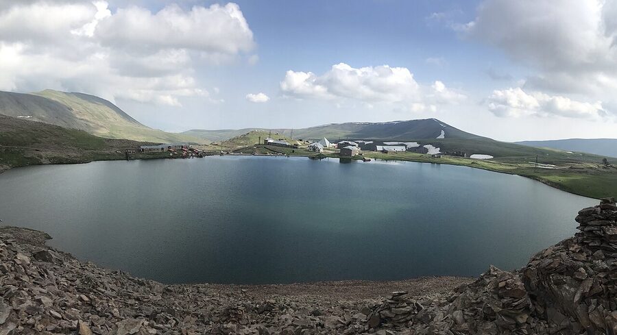
Lake Kari: the trailhead and the end of the road
Almost everything on Aragats radiates from Lake Kari. The small alpine lake sits at 3,200 m on the southern slopes, the paved road ends right there, and the trailhead, the only restaurant on the mountain, and the cosmic ray research station all share the same small basin. Park up, walk fifty metres in any direction, and you’re at the start of something.
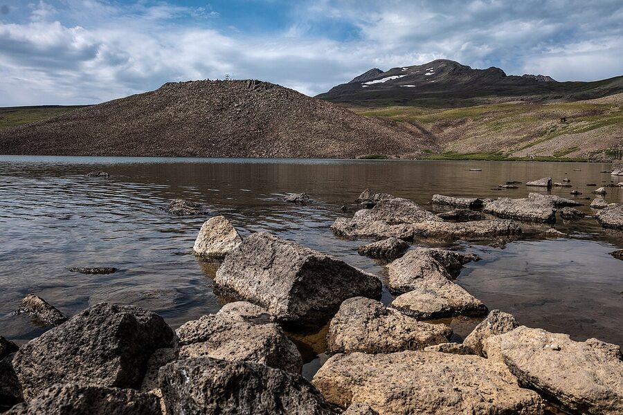
The lake itself is small (you can walk around it in about thirty minutes), and it freezes for roughly eight or nine months of the year. In late July and August the surface thaws and a few brave hikers swim. It’s not warm, even at 1 p.m. in August. The water comes from snowmelt and stays close to single digits Celsius. Bring a towel if you intend to actually get in.
The Aragats Cosmic Ray Research Station
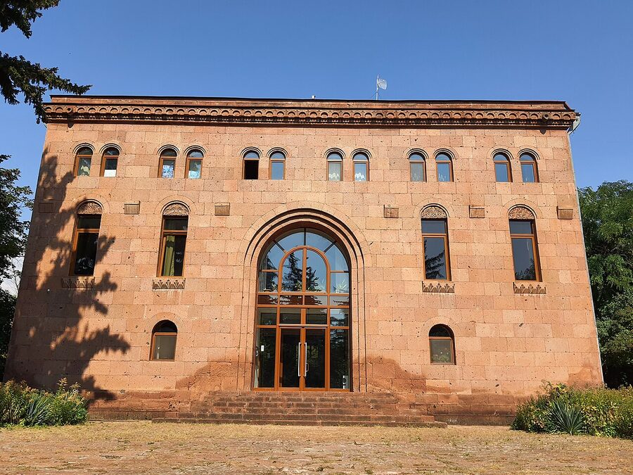
The cluster of low buildings on the western shore is the Aragats Cosmic Ray Research Station, run since 1943 by what’s now the A. Alikhanyan National Laboratory. It uses Aragats’s altitude (high atmosphere, thin air, low background) to study secondary cosmic rays and lightning-related particle bursts. The station is an active research facility, not a museum, so you can’t tour it. You can, though, read the small Soviet-era plaques on the outer walls and walk around the perimeter, which is about as Cold-War-meets-the-Caucasus as anywhere in the country gets.
The hotel and restaurant at Kari
There’s a small hotel-restaurant at the trailhead. I want to be straight about this: it has a bad reputation among hikers who actually try to eat there. Several recent reviews, including from writers I trust, describe overpriced khash, grumpy service, and food that arrives reheated. The flip side is that the same building has, at different times, been the site of warm impromptu lunches between Armenian families and wandering tourists. So your mileage genuinely varies, day by day, party by party.
The practical takeaway: don’t depend on it. Bring your own lunch up to the lake. A loaf of lavash, some sulguni cheese, a couple of tomatoes, and a thermos of coffee from a Yerevan supermarket is fifteen minutes of shopping and infinitely less stressful than negotiating khash with someone who didn’t want you to walk in.
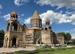
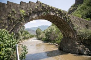
Amberd Fortress and Vahramashen Church
The fortress on the way up to Lake Kari is what makes Aragats more than a hike. Amberd sits on a triangular spur at 2,300 m where two river canyons meet, and from the seventh century onward it was the main mountain stronghold of the Pahlavuni princes, the same family that gave Armenia its medieval high-water mark in monastic architecture. The walls run about 200 m along the spur and drop off sharply on two sides; whoever picked the spot understood defensive geography from the ground up.
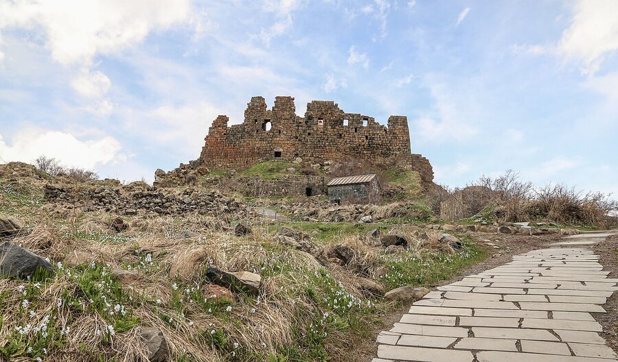
You can walk through the fortress freely. There’s no entrance fee, no ticket booth, nobody policing what you can touch. That openness is part of why Amberd is one of my favourite stops on this side of Armenia. You can sit in what was the bath complex, look down at the Arkashen and Amberd river gorges from the ramparts, and try to make sense of how anyone moved supplies up here in winter. The Mongols sacked it in the thirteenth century and it was already half-abandoned by then.
The Vahramashen Church next door
About 200 m from the main fortress walls, on a separate rocky outcrop, sits Vahramashen Church, a compact eleventh-century cross-domed church commissioned in 1026 by Vahram Pahlavuni, the same prince who reinforced the fortress. It’s small, with a single drum and conical dome, and the masonry is the orange-red local tuff that gives most of Armenia’s medieval churches their warm colour. It looks at first glance like dozens of other small Armenian churches, which is part of the point: Vahram Pahlavuni was building to a mature, settled idiom, not inventing one.
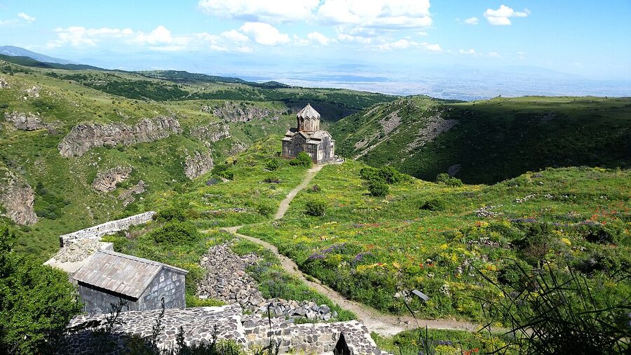
Inside the church is dim, plain, and almost always empty. There’s nothing to buy, no candles for sale, no priest. If you’re driving from Yerevan to Lake Kari, Amberd is the natural lunch stop, about ninety minutes in, an hour above the Yerevan plain, and the elevation here is mild enough that you can eat without your appetite vanishing the way it does at Kari.
The Alphabet Park
About 20 km northeast of Byurakan, on a ridge above the village of Artashavan, sits one of the more unusual public art installations in Armenia: a field of carved tuff sculptures, one for each of the 39 letters of the Armenian alphabet, laid out in roughly the order Mesrop Mashtots invented them in 405 CE. The park opened in May 2005 on the 1,600th anniversary of the alphabet, and the pieces are big. Most are taller than a person, the larger ones are over two metres.
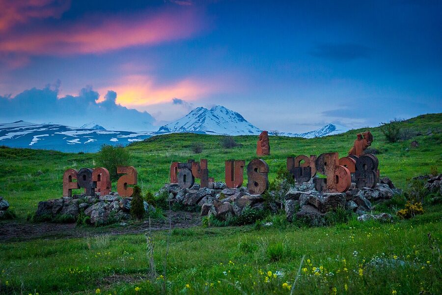
It is, by Armenia standards, a young site, and a few of the carvings are starting to weather. Don’t expect the polish of a state museum. What you get instead is a working memorial. Armenian schoolchildren get bussed up here on field trips, families pose for photos with their initials, and the sculpture of Mashtots himself is the unofficial centre of the park.
It’s a fifteen-minute stop if you breeze through it, an hour if you want to read each letter and have a coffee at the small cafe on the ridge. If you’re doing Aragats as a full day, Alphabet Park works well at the start (on the way up, while you still have energy) or at the end (on the way down, with the late light catching the tuff). I prefer it at the end. The light is better and you’ve earned the slow stroll.
Byurakan Observatory and the ROT-54 radio telescope
Two kilometres outside the village of Byurakan, at 1,405 m, the Byurakan Astrophysical Observatory has been one of the world’s significant centres for the study of galactic structure since Victor Ambartsumian founded it in 1946. This is not a tourist observatory dressed up for visitors. It’s an active research site. The telescope domes look like every other observatory dome you’ve ever seen, which is part of the appeal: you can stand on the access road and watch one rotate at dusk while a Soviet-era staff bus collects astronomers from the campus.
You can visit the small museum (open by arrangement; phone ahead through the observatory’s public-affairs office) and walk parts of the grounds. The campus is easier to read if you go with a guide, but you can also just spend half an hour here on the way up to or down from Kari and call it good.
The ROT-54 telescope at Orgov
The stranger and more photogenic instrument is the ROT-54 radio-optical telescope at Orgov, a few kilometres west of Byurakan. Built in 1985 by the radiophysicist Paris Herouni, it has a 54-metre concave reflector ring carved into the hillside, with a 5-metre optical telescope mounted in the centre. It looks like a piece of Soviet sci-fi set design and is half-abandoned. Herouni’s company still nominally maintains it, but the dish is showing its age. From the access road below you can see the whole structure framed against the slopes of Aragats. You can drive up close, but not enter.
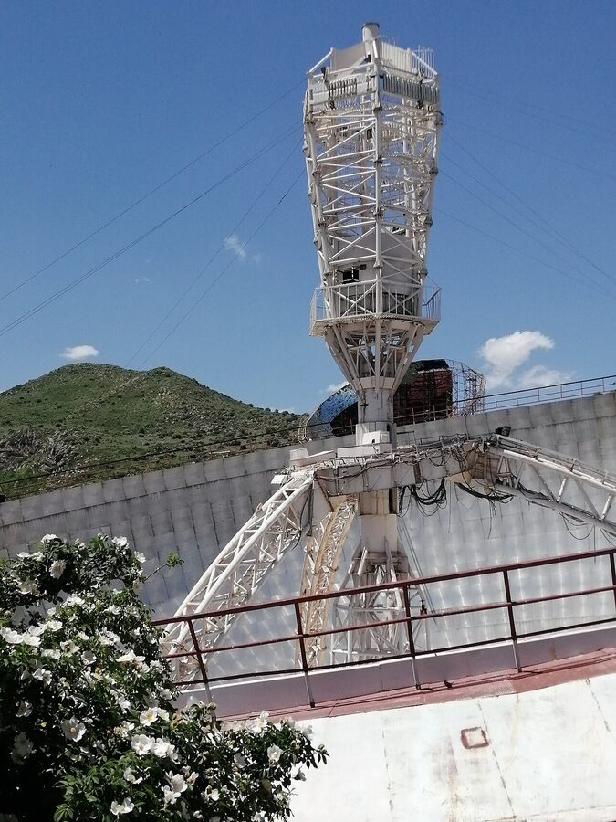
If you have a spare hour and you’re interested in industrial-architectural curiosities (the kind of person who detours for old radar stations, brutalist train depots, or abandoned cable-car pylons), this is worth the side trip. If you don’t, skip it without regret and use the time at Amberd instead.
Getting there from Yerevan
Aragats is about an hour and a half from Yerevan by car, but only if you’re driving straight to Kari Lake without stops. Add Amberd, the Alphabet Park, and a coffee in Byurakan and you’re easily looking at three to four hours of road time over the day, plus six on the mountain. Plan accordingly.
Renting a car
For Aragats specifically, this is the option I’d default to. The road from Byurakan to Lake Kari is paved most of the way, decent in summer, and a small economy car will get you up there from June to mid-September without trouble. Outside that window (late May with patchy snow, early October with the first dustings), you want at least a 4WD, and after the first proper snowfall the road is closed entirely.
Local Rent and Naniko both consistently come in cheaper than the international names for week-or-longer rentals from Yerevan. International chains have desks at Zvartnots Airport but their Armenia-only inventory tends to skew small and pricey. Whatever you book, confirm winter tyres are mounted between October and April and check what the deductible looks like. A stone chip on this road is not unusual, and the deductible on lower-tier insurance will sting.
Hiring a driver via GoTrip
If you don’t want to drive yourself but you do want flexibility (the right to spend an extra forty minutes at Amberd, or skip the observatory if you’re tired), hiring a private driver is the better option than a fixed tour. GoTrip is the platform most travellers in Armenia and Georgia end up using. You set the route, you pick the stops, you agree the price up front, and the driver works for you for the day, not the other way around. A Yerevan-Aragats round trip with the standard four stops (Alphabet Park, Byurakan, Amberd, Kari) typically lands around 28,000 to 35,000 dram for a sedan, more for an SUV, and you can split the cost if you’re a group. The drivers don’t usually speak much English, but the platform’s app handles route negotiation in writing, which makes it easier than it sounds.
Joining an organised tour
Several Yerevan tour operators run Aragats day trips, and unlike most of the country’s tour inventory, this one is actually well-served on the international booking platforms. The two day-trip products I’ve seen consistently surface in searches are a combined “Alphabet Monument + Lake Kari + Amberd Fortress” route and a dedicated “Mount Aragats hiking tour” for fitter travellers who want the south peak as the day’s main event.
For the cultural day-trip version (no actual hiking), check the listings on Viator and GetYourGuide, both of which carry the Alphabet-Kari-Amberd route from multiple operators.
For the hiking version (south peak with a guide), GetYourGuide has a small-group day hike that runs from June through September, and Viator lists a jeep-and-hike combo that handles the trickier parts of the road for you.
Skip group tours if you’ve ever found yourself frustrated by them in other countries. Aragats works best at your own pace.
Public transport (with caveats)
The cheap option is a marshrutka from Yerevan to Byurakan, then taxi or hitchhike up to Kari. The marshrutka leaves from Kilikia Bus Station, currently around 10:30 a.m., though schedules shift seasonally and the station office is the only reliable source. From Byurakan, taxis charge 8,000 to 12,000 dram one-way to Kari, non-negotiable in summer because demand outstrips supply. Some travellers hitchhike up successfully, but you’re at the mercy of who’s on the road, and there are weekends when traffic dries up after lunch.
If your time in Armenia is tight, public transport here is false economy. If you have all day and you’re in no hurry, it can be a good story.
When to go
The hiking season on Aragats is short. Late June through mid-September is the reliable window for the south peak. The road is open, the snowfields above the saddle are mostly gone, and afternoon thunderstorms are predictable rather than violent. Outside that window:
- May: The road may still be blocked above 2,500 m. Amberd Fortress is open and accessible, but Kari Lake itself is touch-and-go through the first half of the month.
- October: The first snowfall typically hits in the first or second week. Some years you can hike clean weather right through to mid-October; some years winter arrives by the 5th and shuts everything down.
- November to April: Aragats is a winter mountain. The road is closed past the lower observatory, the lake is frozen, and the south peak goes from a moderate hike to a serious cold-weather objective. Skiers do come up here for ski-touring, but it’s a different sport.
Inside the summer window, weather is the bigger variable than the calendar. Storms build over the caldera by late morning almost daily. Start early, summit by 11 a.m., and aim to be back at Kari by 2 p.m. at the latest. Six in the morning is not too early to leave the lake. Five is better.
The afternoon storm pattern
This deserves its own note because hikers who fly in from sea level often underestimate it. Aragats is high enough and isolated enough that convective clouds form right over the caldera most summer afternoons. They build slowly between 10 and noon, lock in by 1 or 2 p.m., and almost always produce rain or hail, often with thunder. On the south peak this is uncomfortable. On the western or northern peaks, particularly on the ridges, it’s actively dangerous. Lightning kills hikers in this part of the world every year. If clouds are building and you haven’t summited yet, turn around. The mountain isn’t going anywhere; you can come back.
What to pack
For the south peak in July or August, you want:
- Layers, including a real shell. It can be 25C in Yerevan and 4C with hail at the saddle. Three layers (base, fleece, waterproof shell) are the minimum.
- Two litres of water per person, minimum. Three is better. There’s nothing reliable to drink between Kari and the summit.
- Sun protection. At 3,500 m the UV is fierce, and there’s no shade above the saddle. Sunscreen, sunglasses, a hat that won’t blow off in wind.
- Lunch from a Yerevan supermarket. See the note on the Kari restaurant above. Lavash, hard cheese, dried fruit, nuts, a couple of tomatoes.
- Trekking poles. Optional going up; useful coming down on the loose scree.
- A printed or offline map. Maps.me has the south-peak trail well; Wikiloc has a couple of GPX tracks. Don’t rely on phone signal. There isn’t any above Kari.
- Toilet paper. No facilities on the trail.
For the west or north peaks, add: an ice axe and crampons (north only, even in summer), a 30-litre pack instead of a 20, real boots not trail runners, and a partner who knows what they’re doing.
How Aragats fits into a wider Armenia trip
If you’re planning a week to ten days in Armenia, Aragats slots in nicely on a single full day, ideally early in the trip while you’re still acclimatising and have energy. The day pairs well with two or three nights in Yerevan as your base. See Yerevan in 48 hours for a way to use the bookend time around the Aragats day. Once you’re back, the natural progression is south to Tatev and the Wings of Tatev cable car in Syunik, north to Lake Sevan, or northeast into the forested switchbacks of Dilijan National Park. Aragats gives you the country’s biggest mountain day; Tatev gives you its most dramatic monastery; Sevan gives you the inland sea; Dilijan gives you the green, wet, forested Armenia that surprises every first-time visitor.
For getting between these places, see getting around the country. The marshrutka and shared-taxi network handles most of it cheaply if you have time, and a hire car covers the rest.
One more thing about the mountain itself
Aragats has a quiet but consistent place in Armenian self-image. It’s on the obverse of the 10,000-dram banknote, behind a portrait of the poet Avetik Isahakyan, who was born in Gyumri at its northern foot. The poet Marietta Shaginyan compared it to “a half-open bud of a giant pomegranate flower,” which is the kind of metaphor that makes more sense when you’ve actually seen it from a distance. The four-peak silhouette really does fan out like petals from a single base.
In May 2005, on the anniversary of the First Republic, around 250,000 Armenians formed a 163-kilometre ring of joined hands around the entire mountain. They called it the Dance of Unity. Robert Kocharyan, the president at the time, was in the chain. So was the catholicos. They wanted Guinness recognition; whether they got it or not, the photographs are the kind of national-mythmaking image that doesn’t translate well outside the country and means everything inside it.
There’s also the legend that’s older than the banknote. Aragats and Ararat, in the Armenian telling, were sisters. They quarrelled and parted, and Ararat is now in Turkey while Aragats stayed home. From the south peak on a clear day, you can see Ararat across the closed Armenia-Turkey border, big and white and impossible to reach. Whether that legend lands for you depends on how seriously you take folk geography. For me, it’s just a useful frame. Aragats is what Armenians have, and Ararat is what they can only look at, and the mountain across the valley defines the one you’re standing on.
The southern peak verdict, restated
If you take one thing from this guide: do the south peak, do Amberd, do the Alphabet Park, and treat the day as one big Aragats day rather than four separate stops. The north peak is for mountaineers. The south peak is for travellers. The fortress and the alphabet park are for everyone. Bring your own lunch. Start early. Watch the clouds.
And one practical sentence to close on: pick a clear day, even if it means rearranging your itinerary. Aragats in cloud is a long drive to a parking lot. Aragats on a blue-sky morning is the best mountain day you’ll have in Armenia.
.jpg)