Dilijan is the place people add to the itinerary when they want a break from the monasteries. That sells it short. The monasteries are part of the park, not the alternative to it.
It’s worth getting that the right way around before you go. Dilijan National Park is 240 square kilometres of mostly forest in Armenia’s northeast, ranging from about 1,070 metres up to 2,300, draped over five mountain ranges and stitched together by a trail network that’s been steadily improved since 2017. Inside it sit some of the country’s most-visited medieval sites: Haghartsin, Goshavank, Jukhtakvank, Matosavank, plus the smaller Aghavnavank that almost nobody goes to. Outside the park’s northwest corner, the spa town of Dilijan acts as the base camp.
If you arrive thinking of it as a half-day stop on a bigger Caucasus tour and you’re back in Yerevan by dinner, you’ve seen Haghartsin. You haven’t seen Dilijan. The park rewards the second day, and especially the slow walk between the monasteries rather than the taxi between them. That’s what this guide is built around.
I’ll cover what’s actually here, how to get to it, where to stay, what to skip, and which hikes earn the trip out. Most of it is doable without a car if you don’t mind walking. None of it requires a guide unless you want one. Compared with the bigger-name day trips out of Yerevan to Garni Temple, Khor Virap, or Tatev Monastery, Dilijan is the one where the country itself is the attraction. The drive is shorter than to Tatev, the walking is better than at Khor Virap, and unlike Mount Aragats, you don’t need a four-wheel drive or alpine kit to see the best of it.
In This Article
- What the park actually is
- The shape of it on a map
- Forest, not just trees
- Animals you might actually see
- The monasteries, ranked by what they actually give you
- Haghartsin, restored and worth it anyway
- Goshavank, the village monastery
- Jukhtakvank: the twin churches
- Matosavank, the one being reclaimed by the forest
- Aghavnavank, the one nobody visits
- The lakes, and which one to pick
- Parz Lake (Parz Lich)
- Gosh Lake (Goshi Lich)
- Hiking: the part most people skip
- The day-hike shortlist
- The Little Switzerland five-day trek
- What to actually carry
- The actual risks on the trail
- Dilijan town: the part that isn’t trees
- Old Dilijan
- The Geological Museum and Art Gallery
- The Tourist Information Centre is the actual hub
- Where the food is decent
- Getting there, and getting around
- Marshrutka from Yerevan
- The return trip
- Coming from Tbilisi
- Taxi versus rental car
- Where to stay
- In Dilijan town
- In Gosh village
- Camping
- When to go
- Late spring (mid-May to mid-June)
- Summer (mid-June to late August)
- Autumn (September to mid-October)
- Winter (November to March)
- Practical things worth knowing
- Entrance fee, or the lack of one
- Mobile signal and internet
- Cash, cards, ATMs
- Language
- Bringing kids
- What to skip
- How to actually plan it
- The two-day version
- The three-day version
- The five-day version
What the park actually is
The park was a state nature reserve from 1958 onwards, then upgraded to a national park in 2002. The boundaries didn’t change with the name change. What changed was that Dilijan town and several smaller villages, plus a stretch of the old Yerevan-Ijevan railway, all sit inside the park rather than next to it. The general management plan is still being clarified. In practice that means you’ll walk through farmland, past beehives, alongside a working road, and into proper forest in the same morning, and none of those edges are signposted.
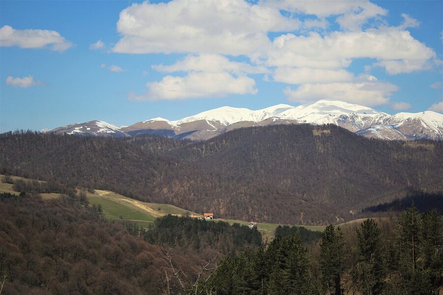
The shape of it on a map
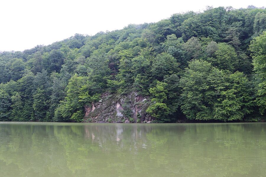
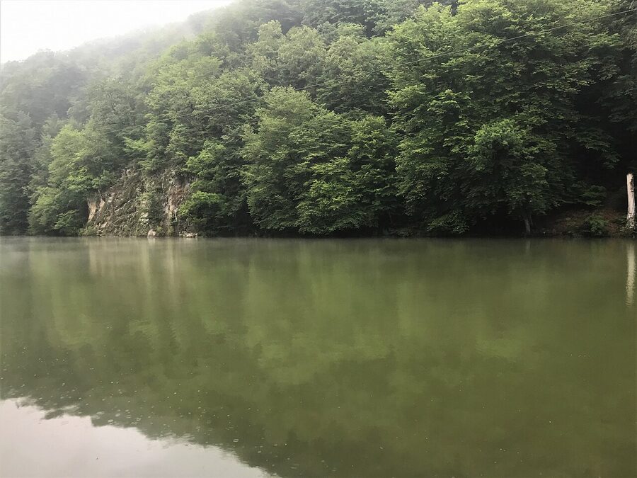
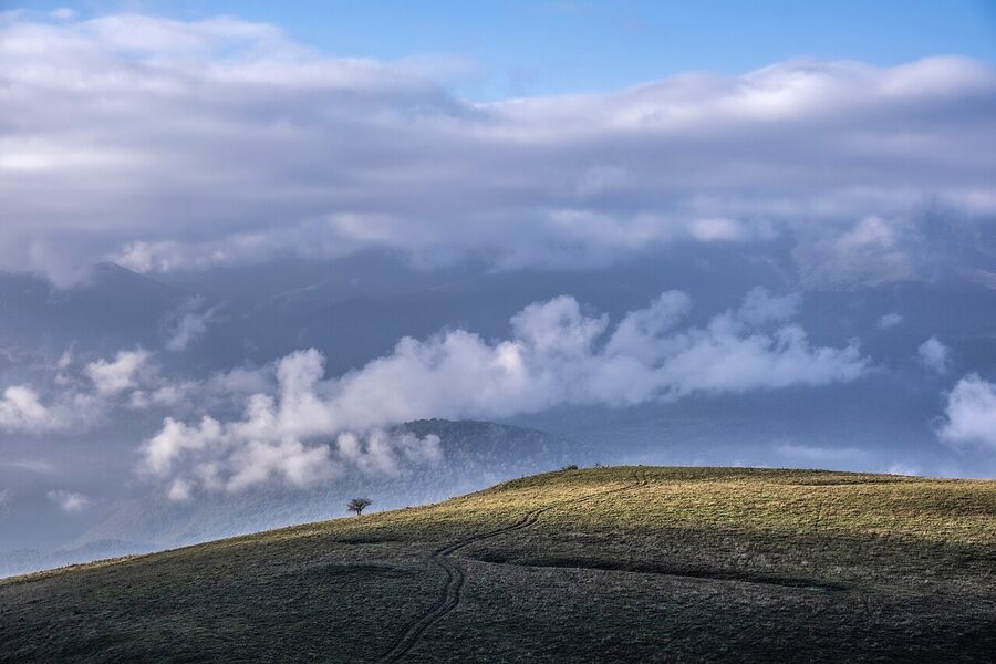
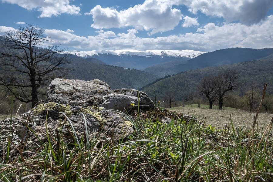
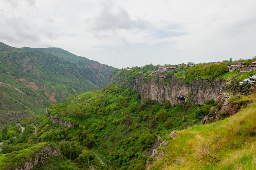
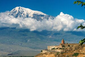
Dilijan sits in Tavush Province, in the country’s wet, green northeast. The park stretches across the slopes of five mountain ranges: Pambak, Areguni, Miapor, Ijevan (sometimes called Kaeni), and Halab. The Aghstev River cuts through the middle. Smaller rivers drain into it: Hovajur, Shtoghanajur, Bldan, Haghartsin, Getik. Three lakes sit inside the boundary: Parz Lich (Clear Lake), Goshi Lich (Gosh Lake), and a small one called Tzrkalich (Leech Lake), which I have never met anyone who has actually been to.
From Dilijan town the park essentially fans out east and south. Haghartsin is north of the road, in a side valley. Goshavank and Gosh Lake are east, near the village of Gosh. Jukhtakvank and Matosavank are immediately west of town, less than two hours on foot from the centre. The Transcaucasian Trail’s 80-kilometre showcase section threads through all of this from Khachardzan in the east to Hovk in the west.
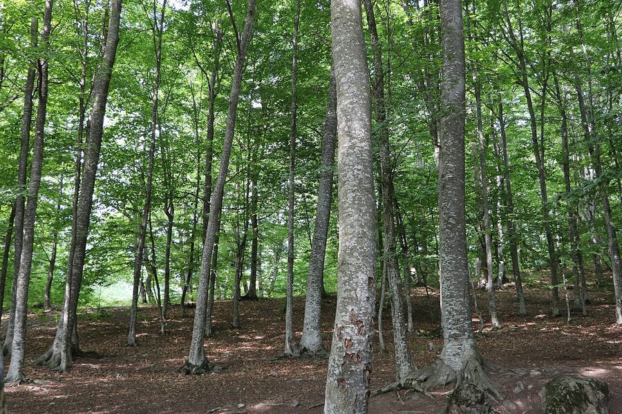
Forest, not just trees
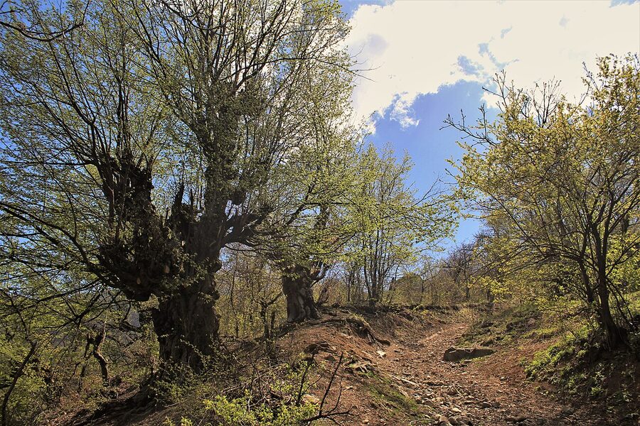
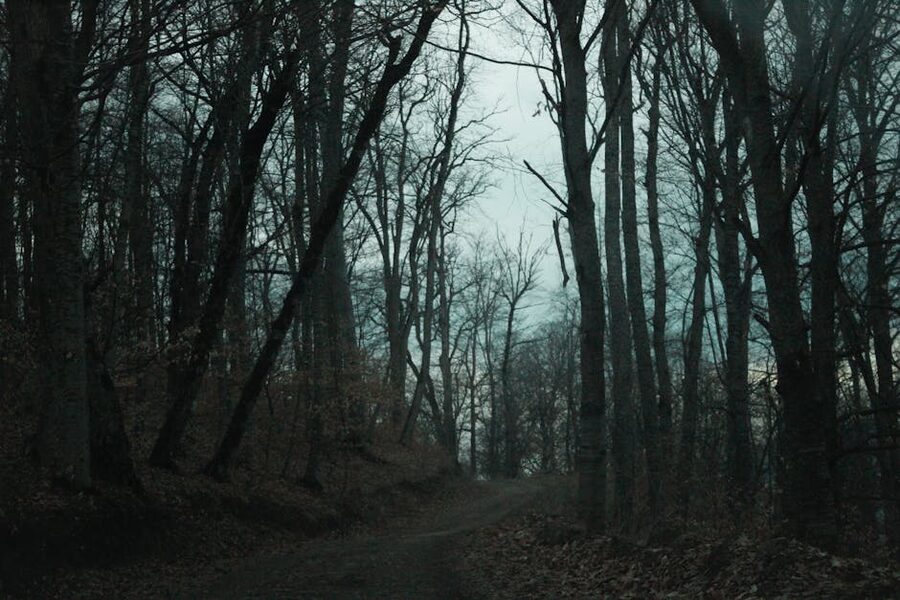
The botany matters more than it sounds, because it’s what makes Dilijan feel different from the rest of Armenia. The country is mostly bare, semi-arid uplands. Dilijan is the wet exception: 902 species of vascular plants, dense oak-beech-hornbeam forest below 2,000 metres, mountain meadows above. Oriental beech (Fagus orientalis) and Caucasian hornbeam (Carpinus betulus) form the canopy, with patches of pine, juniper, and yew on the rockier slopes. There’s a relict yew grove in the Polad river basin that was set aside as a separate reservation in 1958, called Akhnabat Yew Grove, with trees in the 100 to 220-year range. You won’t notice the names. You will notice that you’re in deciduous broadleaf forest, which in Armenia is a small surprise the first time.
The forest is also full of fruit. Wild apple, pear, walnut, hawthorn, blackthorn, medlar, cornel, hazelnut, raspberry. Local guesthouses make jam from a lot of it. If you’ve eaten the breakfast spread anywhere outside Yerevan, some of what was on your plate came from a slope you just walked down.
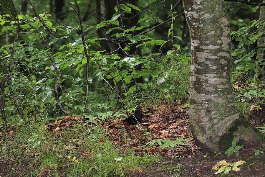
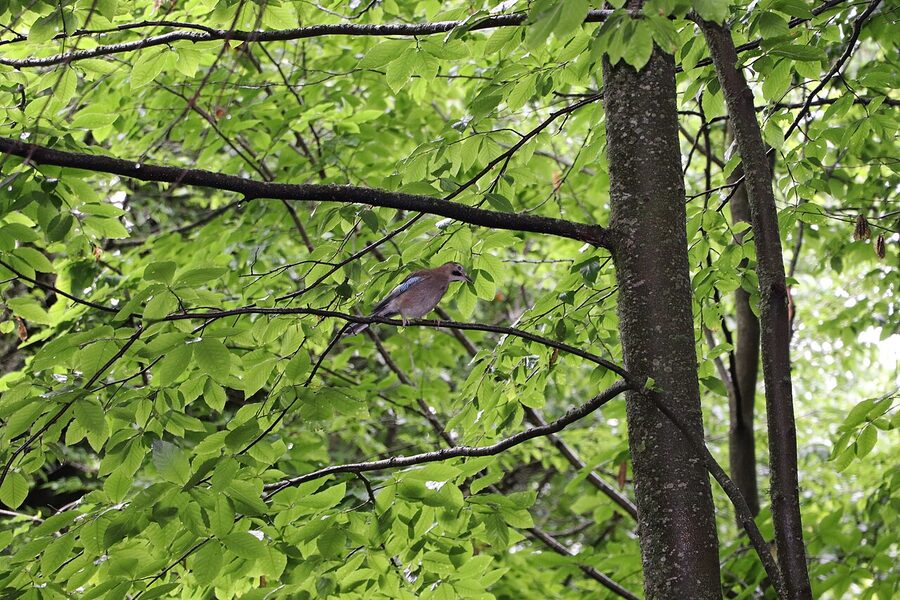
Animals you might actually see
Brown bears live in the park. There are signs along several trails warning about them. Nobody I have spoken to has ever seen one. The proximity to villages and roads keeps them deeper in, and most sightings are of fresh tracks at the edge of meadows in the early morning. Wolves are also resident; same story. Ibex, lynx, wild boar, eagles, the occasional vulture overhead. The park lists a couple of species of eagle as breeding residents. Realistically you’ll see roe deer crossing a forest road if you’re walking quietly at dawn, and you’ll hear birds you can’t name.
Sheepdogs are a more practical concern than bears. The shepherds bring their flocks up onto the meadows in summer, and the dogs guarding them are large and serious. Give them a wide berth, don’t run, and let the shepherd see you. They’ll usually call the dogs off.
The monasteries, ranked by what they actually give you
There are five medieval sites worth knowing about inside the park, plus a handful of half-ruined chapels nobody bothers with. The five aren’t equal. If you only have one day and want to see one monastery, it should be Haghartsin. If you have two, add Goshavank. If you’d rather walk than tick off sites, Matosavank and Jukhtakvank are the ones that reward the trip.
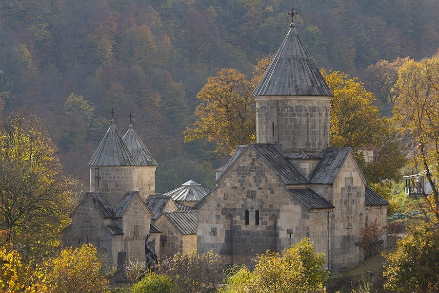
Haghartsin, restored and worth it anyway
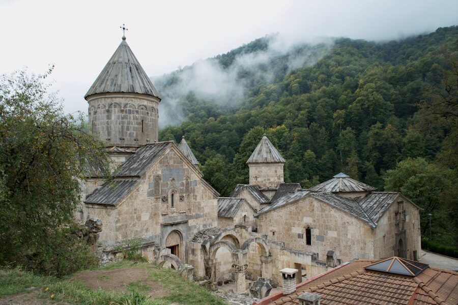
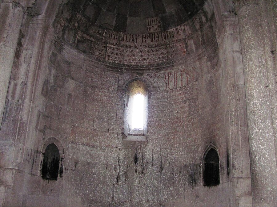
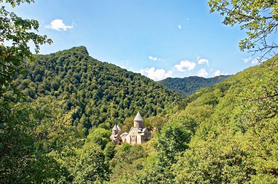
Haghartsin is 13 kilometres east of Dilijan, up a side road that climbs into a forested side valley off the main highway. The monastery is at the head of the valley, on a clearing where the trees pull back just enough. The complex is from the 10th to 13th centuries, with three churches, a refectory, and several khachkars set into the walls and grounds.
It looks suspiciously polished, and there’s a reason. In 2011 a sheikh from the UAE, Sultan bin Muhammad Al-Qasimi of Sharjah, visited, was struck by it, and donated heavily to a restoration fund. Most of what you see has been re-worked since then. Some travellers find this off-putting; I found it makes the building easier to read, because you can tell what was always stone and what’s a 21st-century repair. The carvings on the gavit (the entrance hall) are original. The refectory is original and is the most architecturally interesting room in the complex: long stone barrel vaults, side benches, a smoke vent that still works.
Free to enter. There’s a small parking area, a cafe near the lower end of the valley road that does decent coffee, and a trail off to the right, before the monastery, that drops 1.6 kilometres to a small waterfall. The waterfall is fine. The walk back up is the part that gets you. A taxi return from Dilijan runs around 4,000 dram. Several day-tour operators run combined Haghartsin and Goshavank loops out of Yerevan; the ones that surfaced cleanly in research were on Viator (Viator listing) and GetYourGuide (GetYourGuide listing). Most of these combine Dilijan with Lake Sevan on the way up.
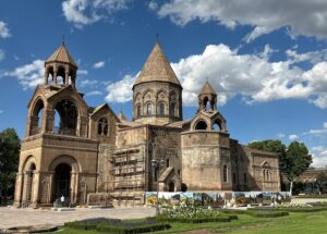
Goshavank, the village monastery
Goshavank is the more interesting of the two if you’re at all curious about Armenia’s medieval intellectual history. It was founded in 1188 by Mkhitar Gosh, a cleric, jurist, and writer who produced the Datastanagirk, the first book of legal opinion in medieval Armenia. The monastery was originally called Nor Getik (New Getik) because it replaced an earlier monastery destroyed by an earthquake. When Gosh died in 1213, it took his name.
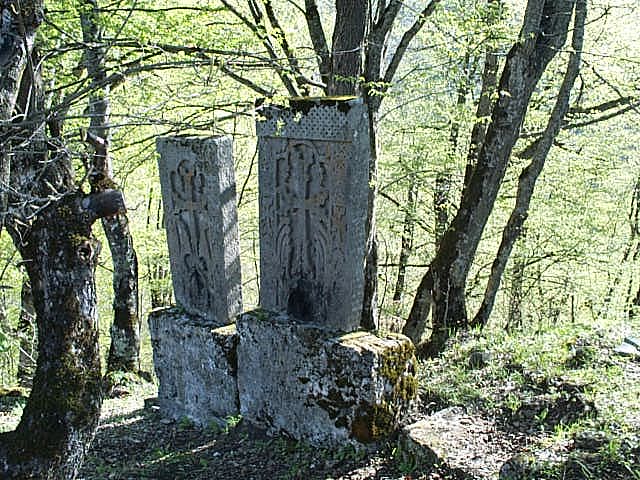
The complex sits inside the working village of Gosh, which is what makes it different from Haghartsin’s clearing-in-the-forest setting. You walk in past houses and gardens. There’s a statue of Mkhitar Gosh at the entrance, sitting with the Book of Law on his lap and a scale of justice in one hand. Inside the complex are three churches, a chapel, a library-scriptorium that doubled as a school, and one of the most-photographed khachkars in Armenia: the Master Poghos cross-stone, intricately worked and signed by its carver, relatively unusual for the period.
If you have the option, stay overnight in Gosh. The Mkhitar Gosh Hotel (Booking | Hotels.com | HikeArmenia listing) is a few minutes’ walk from the monastery. There’s good village food at Hnots Gastro Yard by Arevi (the grilled vegetables are particularly good) and the same family runs the adjacent rooms at Hotel Arevi Gosh.
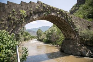
Jukhtakvank: the twin churches
“Jukht” is Armenian for paired or twinned, and Jukhtakvank lives up to it. Two squat, square churches sit a short distance apart on a forested hillside about 7 kilometres from the centre of Dilijan town. Both date to the 11th to 13th centuries. The smaller of the two, dedicated to the Holy Mother of God, is the older. Both got light restoration in the 1970s and are in considerably better shape than Matosavank, which sits across the valley.
To find Jukhtakvank: from the centre of town, walk east past the Tourist Information Centre on the main road, about 4 kilometres. Take the right turn onto Abovyan Street. Pass the Dilijan Mineral Water Plant. The signposted trail is just after that. It climbs through the forest and the churches appear after about ten minutes. The whole walk from town centre takes under two hours one way.
Matosavank, the one being reclaimed by the forest
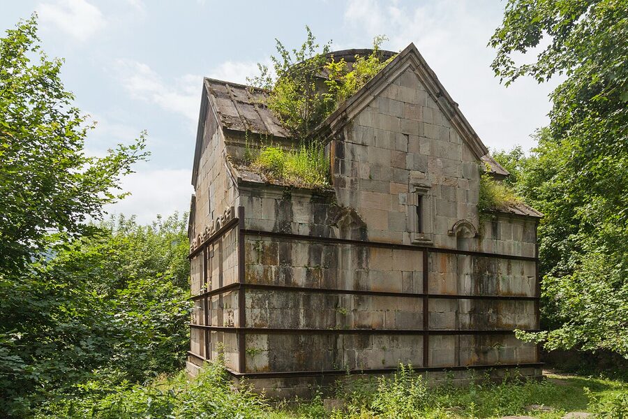
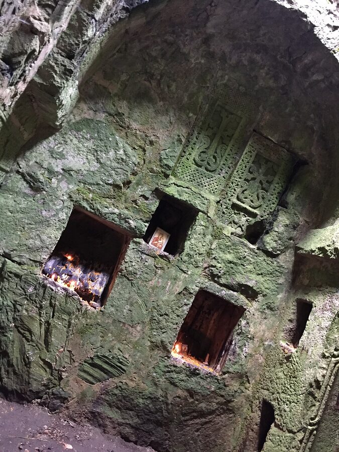
If Haghartsin is restored to a sheen and Jukhtakvank is tidy, Matosavank is the opposite: half-ruined, ivy on the walls, a roof that admits as much sky as it keeps out. It was completed in 1247 under Avag Zakarian-Mkhargrdzeli, a Georgian commander of Armenian descent who’d just submitted to Mongol rule. Avag himself died three years after it was finished. The building has a cruciform floor plan and an unusual number of khachkars set into the interior walls.
It’s reached on the same trail as Jukhtakvank, the one local signage calls the Trail of Medieval Monasteries. From the information board near the river, you follow markers up the wooded hillside and the monastery emerges from the trees, looking like it’s growing out of the ground. In spring, the forest floor around it is carpeted with cowslips, violets, and blue anemones.
Together with Jukhtakvank, this is the easiest half-day loop in the park: the two monasteries, a few river crossings, back into Dilijan in time for lunch. If you’re trying to fit one short hike into a day trip, this is the one to fit.
Aghavnavank, the one nobody visits
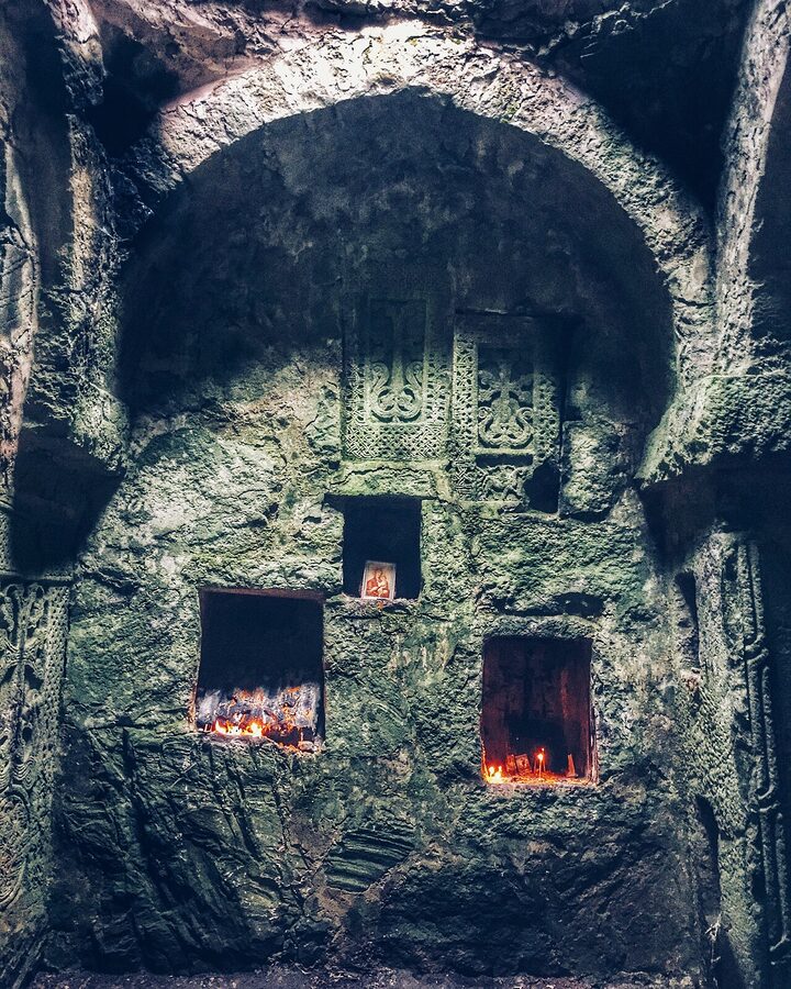
Aghavnavank is on the eastern edge of the park, in the Getik valley near the village of the same name. The 12th- to 13th-century Holy Mother of God Hermitage sits at the foot of a rock outcrop in a forest clearing, with up to 400-year-old yew trees nearby, which gives the trail its name (Yew Grove Trail). To reach it, you cross the bridge in Aghavnavank village, follow the riverside path east on a signposted, flat track for about 30 minutes. Easy walk in and back. Almost no other visitors.
This is where Dilijan starts feeling like a backwoods park rather than a day trip from Yerevan. If you have the second night and you want a quiet morning, drive or hire a taxi to Aghavnavank, walk the trail, eat at one of the village houses if any are doing food that day, and head on to Goshavank in the afternoon.
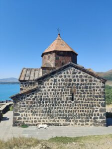
The lakes, and which one to pick
Two of the three lakes inside the park boundary are worth your time: Parz and Gosh. Both are small alpine lakes in dense forest, both reachable on foot, both with clear water and a picnic-friendly shoreline.
Parz Lake (Parz Lich)
Parz means clear, which is fair. The lake is 14 kilometres from Dilijan town, sitting in forest at about 1,400 metres. There’s a restaurant at one end, rowing boats and pedal boats for hire, an hour-long marked loop trail around the water (about 2 kilometres), and a small zipline-and-rope-park setup run by Parz Lake Extreme Park. In summer it’s busy. On a sunny weekend in July you’ll be sharing the shore with families, kebab smoke, and a wedding-photo session or two. Earlier in the day or out of season it’s quiet.
You can get to Parz by taxi or by hiking. The hike up from Dilijan via the Transcaucasian Trail markers (the local trail name is “Twist and Shout”, and you’ll see it on the HikeArmenia app) is the better way to arrive. It’s about 4 hours, starts from the south of town and climbs the ridge before dropping to the lake. Many walkers continue another 4 hours to Goshavank from there, making a one-way trail with a taxi pickup at the end. There’s a GetYourGuide listing for Parz Lake activities (GetYourGuide) if you’d rather book a half-day with logistics handled.
Gosh Lake (Goshi Lich)
Gosh Lake is about 2.5 kilometres uphill from Goshavank Monastery on a marked trail (HikeArmenia calls this one “Oh My Gosh”; funny names are a HikeArmenia signature). The lake is smaller than Parz, more remote, and far less busy. There’s no restaurant, no boats, no rope park. Just water and trees. It’s a 4.2-kilometre return walk from the monastery, and most people who walk in stay for an hour with a picnic.
October is the best month at Gosh. The surrounding broadleaf forest turns through every shade of yellow and red, and you’ll often have the lake to yourself. The walk can be done at any time of year, though winter snow on the trail makes the last kilometre slow.
Hiking: the part most people skip
The hiking is the reason to come if you’re at all comfortable on a marked trail. Since 2017, when the Transcaucasian Trail Association built the 80-kilometre showcase section, Dilijan has had Armenia’s best-marked, best-mapped trail network. The major routes wear red and white paint stripes (the same convention as Georgia’s GR system). Most have gpx tracks on the HikeArmenia app and the Maps.me database. The Tourist Information Centre in town hands out paper maps and rents gear if you didn’t bring it.
The day-hike shortlist
The walks I’d actually do, in rough order of effort:
- Matosavank and Jukhtakvank loop . 7 to 10 km from the centre of Dilijan, 3 to 4 hours, easy. Both monasteries plus a short river-bottom section. The best half-day option.
- Hidden waterfall from Haghartsin . 1.6 km each way, downhill on the way out, uphill back. About an hour return plus time at the waterfall. Combine with the monastery for a short half-day.
- Parz Lake from Dilijan (“Twist and Shout”) . About 4 hours, 12 km, medium difficulty. The first section through dense forest, the second along an open ridge.
- Gosh to Dilijan via Parz Lake . 22 km, 6 hours, medium to hard depending on weather. Take a taxi to Gosh in the morning, walk back.
- Nature Pilgrimage to Haghartsin . 12 km one-way from town, hard, poorly marked in places, not officially recommended by the Tourist Information Centre. People still do it. Allow a full day and don’t start late.
The Little Switzerland five-day trek
The 80-kilometre Transcaucasian Trail showcase section is the headline trek. It starts in the village of Khachardzan in the east, ends in Hovk in the west, runs four to five days, takes in Goshavank, Jukhtakvank, Haghartsin, and a side trip to Parz Lake. Guesthouses are available at all but one overnight stop (the Haghartsin section), so you can either camp that one night or push through. The trail is marked with TCT-branded posts plus the standard red-and-white paint.
This is the trek the park is genuinely known for in trail-walking circles. If you’ve done the Mestia-to-Ushguli route in Georgian Svaneti, this is the Armenian counterpart in spirit, though gentler underfoot and more forest-shaded. Self-sufficient hikers can wild-camp anywhere; everyone else should book guesthouses ahead in summer because they fill up. The Transcaucasian Trail Association’s site has gpx files, a print-friendly trail-notes pdf, and accommodation contacts.
What to actually carry
The trails are mostly forested, well-shaded, and not technically demanding. The risks are sun and water in summer, mud and ice in shoulder season, snow in winter. You don’t need crampons or technical kit at any time of year for the marked routes. What you do need:
Water, at least 2 litres per person for a half-day hike, 3 for a full day. Streams are common but I would not drink from them without filtering. The Tourist Information Centre rents filters along with the rest of the gear. Snacks. A real lunch if you’re out for more than five hours, because the only food stop on most of these trails is the Parz Lake restaurant, and it’s seasonal. A waterproof, even in summer; afternoon thunderstorms are common from June through August. A phone with maps downloaded; cell coverage in the park is mostly good but not universal. Layers, including a fleece or light puffy for early starts and the higher ridges.
The actual risks on the trail
Bears, technically. Sheepdogs, more often. Giant hogweed (which causes serious skin burns on contact, and is everywhere in summer along stream banks; long sleeves and trousers if you’re bushwhacking off-trail). Lightning, particularly on ridge sections in July and August thunderstorms. Mist that closes in suddenly at altitude, which makes the unmarked trails harder to follow. The Transcaucasian Trail’s own safety page also flags washed-out bridges and high-water river crossings in spring snowmelt.
None of this is dramatic. Phone signal is generally fine on the major trails, the Tourist Information Centre will know if anything’s closed, and the trail markings are good. People who get into trouble in Dilijan tend to be the ones who left the marked network, ran out of water, or started too late.
Dilijan town: the part that isn’t trees
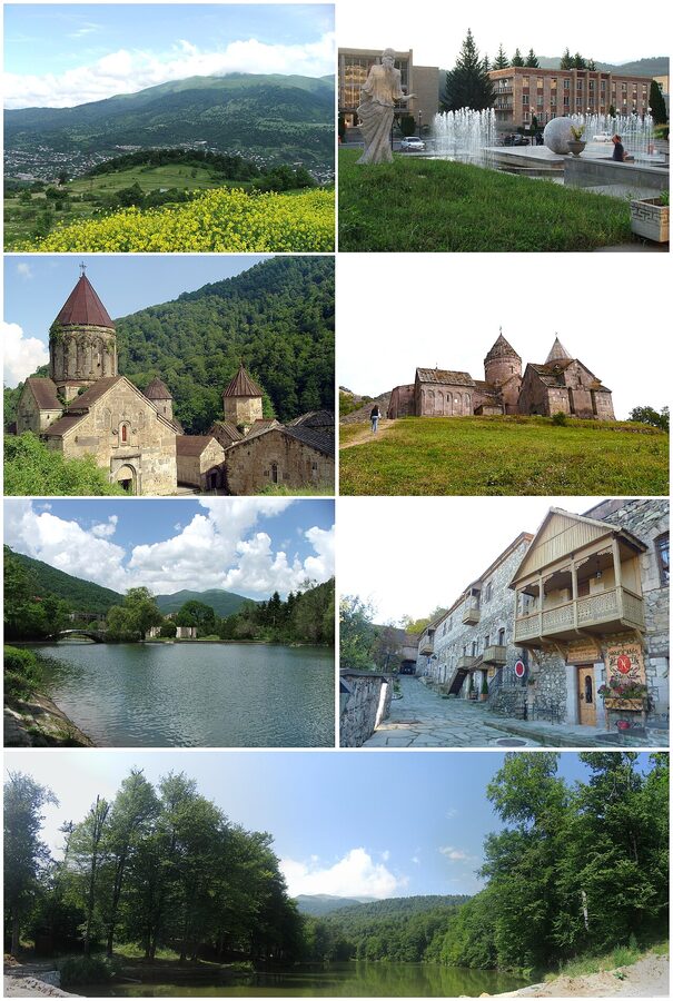
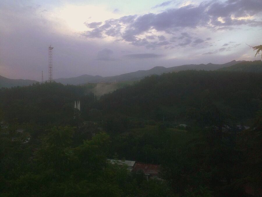
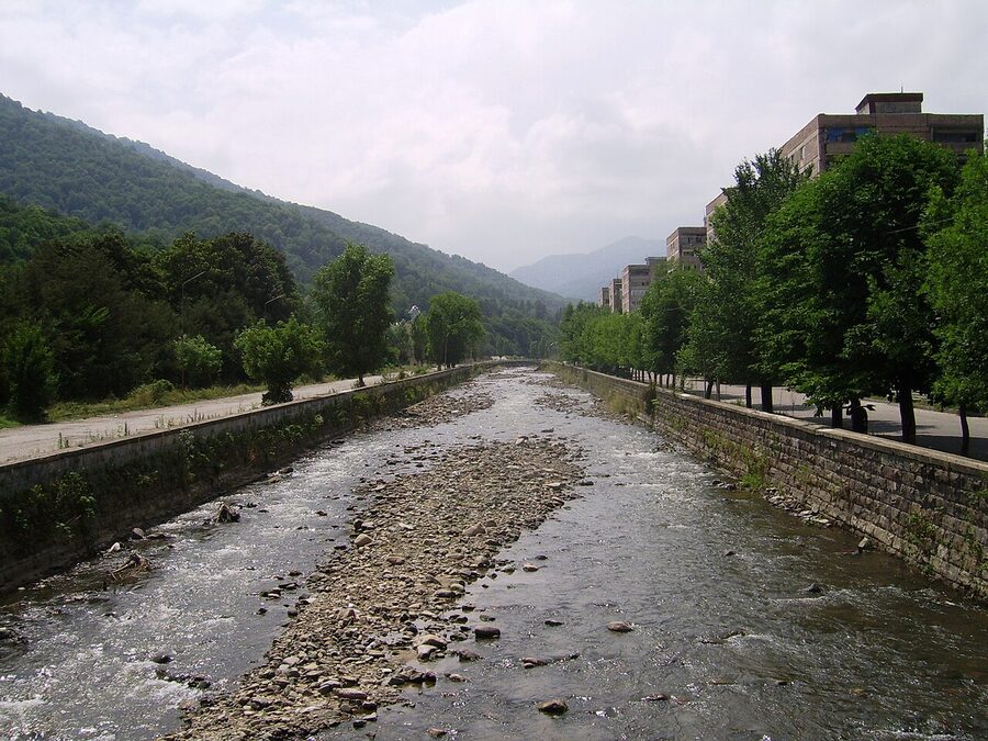
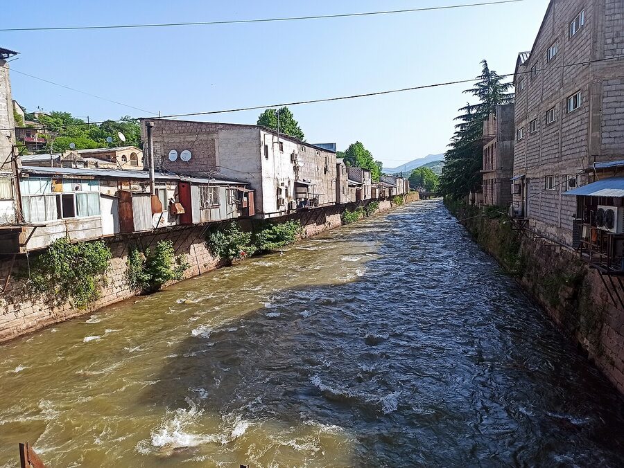
The town has about 17,000 residents, sits on the Aghstev River at around 1,500 metres, and was a Soviet-era mountain retreat for artists and writers. Bits of that era are still visible in the wooden balconies and the layout of the older streets. The Aghstev itself runs cold and clear and is the geographical spine of the town.
Old Dilijan
Old Dilijan is a single restored 19th-century street with carved wooden balconies and craft workshops. It’s more accurately an open-air museum than a real district. Most of what surrounds it is Soviet-era apartment blocks. Some travellers find it charming. I find it pleasant for an hour: walk the street, look at the workshops (woodwork, jewellery, ceramics), have a coffee, move on. The Tufenkian Old Dilijan Complex hotel sits inside the restored area itself; even if you’re not staying there, the courtyard is worth a look. (Booking | Official site.)
The Geological Museum and Art Gallery
Two collections, one building, in the centre of town. The geology side is small but properly old-school: labelled rock samples, fossils from the surrounding mountains, a few pieces of meteorite. The art gallery upstairs is more interesting: a quiet collection of Armenian and Russian paintings, including a few Aivazovskys and a couple of works that look very much like minor Saryans (which makes sense, given Martiros Saryan spent time in Dilijan). Both worth an hour on a rainy afternoon.
The Tourist Information Centre is the actual hub
This is the single most useful building in town for a hiker. They have maps, both print and digital, of every marked trail in the park. They rent mountain bikes (pretty good ones), tents, sleeping bags, walking poles, even bear-bell sets. They speak English, can call ahead to guesthouses on the trail, and run a small free shuttle to a couple of trailheads. The HikeArmenia organisation has its main office here too. Even if you’re not hiking, drop in for the maps; it’ll save you 30 minutes on the first morning.
Where the food is decent
Cafe Number 2 is the obvious one. It sits on the central square across from the marshrutka stand, with a view over the small town lake, a long drinks menu, and food that ranges from Armenian standards to passable salads and pizzas. It’s open all day and is the easiest place to settle in for an hour with a laptop.
For something more substantial, Kchuch (named after the clay pot it cooks in) is worth the trip. It’s about 15 minutes’ walk from the centre, sits in a converted house, and does a kchuch (a slow-cooked meat-and-vegetable stew baked in the eponymous clay pot) that’s better than any version I’ve had in Yerevan. Book ahead in summer.
Cheap and excellent: the wooden Jingalov Hats stall next to the Tsiran supermarket, doing the Artsakh-style flatbread filled with herbs for around 500 dram. The mix of greens varies by day (sorrel, spinach, cilantro, occasionally nettle), but it is one of the best snack-food experiences in the country and the same family runs it as has run it for years. See the traditional Armenian food guide for context on jingalov hats and the wider cuisine.
Getting there, and getting around
Dilijan is about 100 kilometres from Yerevan by road, climbing through the Sevan basin and then dropping over the Dilijan Pass. The drive takes between an hour and a half and two and a quarter hours depending on traffic. You don’t need a car, but it makes the multi-day version of this trip easier. Full transport mechanics are in the Armenia transport guide.
Marshrutka from Yerevan
The standard option. Marshrutkas (minivans, locally called “elektrichka” by older speakers and “marshrutka” by everyone else) leave from Yerevan’s Northern Bus Station, which is 10 kilometres out of the city centre. Bus 259 from the stop on Mesrop Mashtots Avenue, outside Karas Restaurant in central Yerevan, drops you at the bus station for around 200 dram in 30 to 45 minutes depending on traffic. A taxi to the bus station is about 1,000 dram and takes 15 minutes.
From the Northern Bus Station, marshrutkas to Sevan and Dilijan leave when full; count on every 30 to 60 minutes during daytime hours, less frequently after 4pm. The fare to Dilijan is about 1,500 dram and the trip takes around 90 minutes on reasonable roads.
The return trip
Marshrutkas leaving Dilijan stack up around the central roundabout and depart when full. It’s organised, drivers take turns, you don’t need a reservation in shoulder season. In peak summer (June through August) seats fill quickly and your guesthouse will usually call ahead for you if you ask the night before, which is the difference between a smooth morning and a two-hour wait.
Coming from Tbilisi
If you’re crossing the Georgian border on a Tbilisi-to-Yerevan marshrutka, ask to be dropped in Vanadzor, the major town in northern Armenia, 35 kilometres from Dilijan. From Vanadzor there are several marshrutkas a day to Dilijan, about 700 dram, 45 minutes. This is the natural way to break a Tbilisi-Yerevan trip into two days, with a stop in Dilijan for hiking.
Taxi versus rental car
A return taxi for the day from Yerevan to Dilijan, hitting Haghartsin, Goshavank, and the town, runs about 30,000 to 40,000 dram (around USD 75 to 100) depending on bargaining and current fuel costs. That’s reasonable for two or more travellers and gives you the flexibility to stop at viewpoints and skip what you don’t want. A rental car from Yerevan is about USD 35 to 50 per day plus fuel, which works out cheaper if you’re staying two nights.
Yandex Taxi works in Dilijan and is cheaper than flagging cars down for short hops within the town. For trips to monasteries, Yandex sometimes fails (drivers won’t always go to remote monasteries) and a pre-booked taxi from your guesthouse is more reliable.
Where to stay
Dilijan town has about 100 guesthouses and small hotels, plus a couple of larger establishments. In summer they fill up; in winter most close. The pattern is to stay in town for the food and the bus connections, or in Gosh village for the trail access and the quiet. Both work.
In Dilijan town
For boutique character, Tufenkian Old Dilijan Complex is the standout. It’s a small heritage-style hotel inside the restored Old Dilijan street, run by the same Tufenkian group that operates several other heritage properties around the country. (Booking | Official site.)
For mid-range chain reliability, Best Western Plus Paradise Hotel Dilijan is a few minutes’ drive from the centre, has a pool and gym, and is the comfortable choice if you want predictable rather than characterful. (Booking | Expedia | Best Western.)
For affordable family-run rooms with the best breakfast you’ll have in Tavush, the smaller guesthouses near the Tourist Information Centre run between 4,500 and 8,000 dram per person per night. Green Garden Guesthouse, mentioned by several writers, is the type: homecooked dinner, English-speaking host, ten minutes’ walk from the centre. These properties usually don’t appear on Booking; you find them through HikeArmenia’s accommodation directory or by emailing direct.
In Gosh village
Gosh has two practical options for trekkers and slow travellers. The Mkhitar Gosh Hotel is the older one, a few minutes from Goshavank, simple but clean rooms. (Booking | Hotels.com.) Hotel Arevi Gosh is the newer one above the Hnots Gastro Yard restaurant, with bigger rooms and better food downstairs. Both work as a base for the Goshavank to Parz Lake hike or as a stop on the multi-day Transcaucasian Trail.
Camping
Wild camping is tolerated in most of the park and explicitly permitted along the Transcaucasian Trail. You can camp behind Goshavank Monastery if you ask the locals nicely. There’s also a campsite at Parz Lake with cabins and tent platforms, run by the same operation as the restaurant, open roughly May through October.
When to go
April through October is the workable hiking season. The shoulders bookend the prime months: April still has snow on the higher ridges and mud on the trails; October starts cold by the third week, and the first frost usually arrives early November.
Late spring (mid-May to mid-June)
The single best window. Wildflowers carpet the meadows, the rivers run full from snowmelt, the leaves are fresh, the temperature is between 12°C and 22°C in town. The trails are firm rather than dusty. Expect occasional thunderstorms by early June. Guesthouses are mostly open by mid-May and prices are still shoulder-season rates.
Summer (mid-June to late August)
Warmest, busiest, most reliable for weather, but also the time when Yerevan itself is hot enough that everyone in the city heads here on weekends. Dilijan town in July can feel surprisingly busy. Trails get more foot traffic, particularly the short Parz Lake and Haghartsin loops, but the longer multi-day hikes are still quiet because most weekenders stay close to the road. Afternoon thunderstorms are common; start early.
Autumn (September to mid-October)
The other peak window, and arguably the most photogenic. Beech and hornbeam turn yellow and copper through September; by the second week of October the colour at Gosh Lake is the best it gets. Weather is more variable than summer, but the days are still mostly clear. Temperatures drop from around 18°C in early September to single digits overnight by mid-October.
Winter (November to March)
Most of the park’s tourism shuts down. Snow blocks the higher trails. Guesthouses close. The town itself stays open but quiet. If you want to ski-tour or snowshoe and you have the experience to navigate without trail markers (paint stripes are buried under snow from December onwards), winter is doable. Skip it unless you have a reason.
Mid-November is the borderline shoulder. The autumn colour is mostly gone, the trails have ice on them by mid-morning, and a couple of guesthouses are still open. Hikeable in clear weather, miserable in anything else.
Practical things worth knowing
A handful of details that don’t fit the section structure but matter on the ground.
Entrance fee, or the lack of one
The park is free to enter, including the monasteries. Some travellers expect a gate and a ticket booth; there isn’t one. Donations boxes inside the major monasteries are voluntary, mostly used for restoration; 500 to 1,000 dram is appropriate if you want to give. Parz Lake’s restaurant and rope park charge for their services but the lake itself is free to walk to.
Mobile signal and internet
Coverage is good for an Armenian national park. A local Beeline or Ucom SIM (USD 5 to 10 for a tourist sim with data) gives you 4G across most of the park, including on the major trails. Cell signal drops in deep valleys and on the high ridges of the Pambak range. Guesthouses and cafes in town have free wifi without exception.
Cash, cards, ATMs
Several ATMs in central Dilijan, all on the Visa/Mastercard network, with daily withdrawal limits around 200,000 dram. The hotels and bigger restaurants take cards. The marshrutkas, the small jingalov hats stalls, and the village taxis are cash. Bring at least 30,000 dram in cash for a two-day visit.
Language
Armenian first, Russian second, English third. Most younger people in the tourism industry speak workable English. Older guesthouse hosts may not. The HikeArmenia trail markers and the Tourist Information Centre signs are in English. Maps.me and the HikeArmenia app are both in English.
Bringing kids
Workable. The shorter trails (Jukhtakvank, Parz Lake loop, the Haghartsin waterfall) are family-friendly and not technical. The Parz Lake rope park and zipline have children’s options. Guesthouses are generally happy with kids and most have at least one family room.
What to skip
The half-day-from-Yerevan tour. It hits Sevan and Haghartsin and you’re back in the car by 2pm. You will see Haghartsin’s restored complex and a slice of forest from a moving window. You will not have seen Dilijan. If you only have one day, do Dilijan-only as a self-driven full day with the Goshavank to Parz Lake hike between the two monasteries; if you’ve only got half a day, do something else.
The Tripeak hike up Andzavabatsat unless you’re fit and starting at first light. It’s a 12-hour bushwhack, occasionally not navigable in late season, and most of what makes Dilijan worth the trip is at lower elevations.
The Aghartsin (sometimes confused for Haghartsin in older guidebooks; they are completely different sites. Aghartsin is a small village west of the park, Haghartsin is the major monastery). If a tour offers “Aghartsin” instead of “Haghartsin”, it’s a typo, not a different destination.
How to actually plan it
If you only have time to dip in, the bare minimum is one full day, ideally with an overnight in Dilijan or Gosh, taking the marshrutka up in the morning and the marshrutka back the next afternoon. Two full days is the version this guide is built around.
The two-day version
Day one: morning marshrutka from Yerevan, drop bags at your guesthouse in Dilijan town, walk Old Dilijan and the Tourist Information Centre in the early afternoon, take the Jukhtakvank to Matosavank loop in the late afternoon, dinner at Kchuch.
Day two: taxi to Gosh first thing, walk Goshavank, then hike from Goshavank via Parz Lake back into Dilijan town (about 22 km, 6 hours, plenty of time for lunch at the lake). Marshrutka back to Yerevan in the evening.
If you’d rather have a slow morning and a shorter walk: substitute the Goshavank to Parz Lake hike for a taxi to Goshavank, an hour at the monastery, an hour at Gosh Lake on the easy loop, then a taxi back. That cuts the day from a 22-kilometre walk to a quiet six-hour outing.
The three-day version
Adds Aghavnavank on day three, plus the Haghartsin valley with the waterfall walk. This is the version where you stop trying to tick off sites and start enjoying being in a forest.
The five-day version
The Little Switzerland Transcaucasian Trail thru-hike, beginning in Khachardzan and ending in Hovk. Full kit list, all five overnights pre-booked or set up for camping, gpx tracks downloaded onto two devices, food planned. This is a different kind of trip from a destination weekend. It’s also probably the best week of walking you’ll do anywhere in the South Caucasus.
Whichever version you do: don’t treat Dilijan as a stopover. The country has plenty of half-day stops, and Dilijan is happy to play that role for the buses that come through. But the people who leave wanting to come back are the ones who walked the second day, ate dinner where the cook also made the wine, and stayed an extra night they hadn’t planned for.