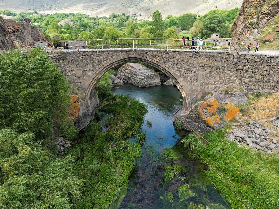
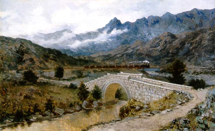
The Sanahin Bridge survived a flood in May 2024 that took out seventeen other bridges in the area. I went to see it in early 2025, after the water had receded but before the inspection report came back, and you could already tell something had shifted. The right-side wall near the foundation was cracked. A local writer in Alaverdi was warning anyone who’d listen that authorities needed to act before the next big rain. The bridge has been there since 1192. It will probably outlast the warning, the way it has outlasted everything else, but standing on its stepped roadway and looking down at the Debed running fast and brown below, I understood why pre-modern travellers paid for bridges and put their names on them. They knew what rivers do.
This is the article I wish I’d had on my first trip. Armenia’s old stone bridges are not a tour-bus circuit. They sit at the bottom of gorges, on the back roads to villages, on borders that don’t open. A few are five minutes off the highway. One is technically in Turkey now. Another sits in territory currently occupied by Azerbaijan and is not visitable at all. What follows is the working list of the historic bridges in Armenia worth the detour, with the practical detail you need to find them, and a verdict on which ones earn the trip.
In This Article
- Sanahin Bridge, Alaverdi
- What’s actually there
- Getting there
- Combine with
- My take
- The Red Bridge, Yerevan
- How to find it
- My take
- Ashtarak Bridge
- Getting there
- My take
- Khndzoresk Swinging Bridge
- Getting there
- My take
- Lori Berd Bridge
- Getting there
- My take
- Oshakan Bridge
- Getting there
- My take
- The Ani Bridge: visible from the Armenian side, not crossable
- How to see it
- My take
- Garni and the Azat bridge
- Getting there
- My take
- Melik Tangi Bridge, Vorotnavan
- Getting there
- My take
- The bridges you can’t visit (right now)
- Practical notes for any of these trips
- When to go
- Driving vs marshrutka
- What to bring
- Combining bridges with the rest of an Armenia trip
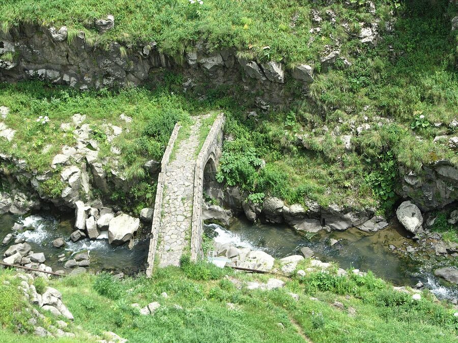
Sanahin Bridge, Alaverdi
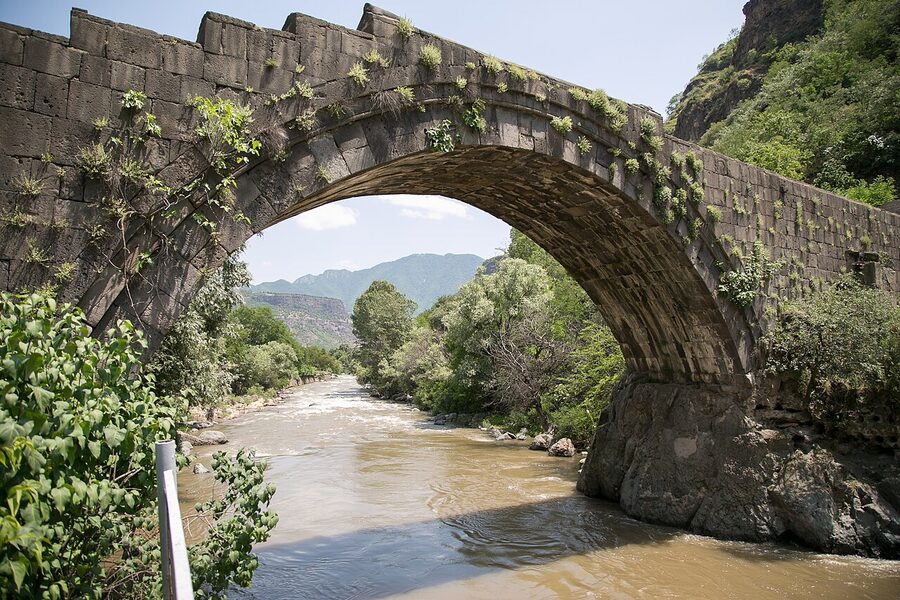
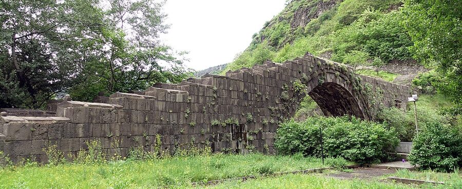
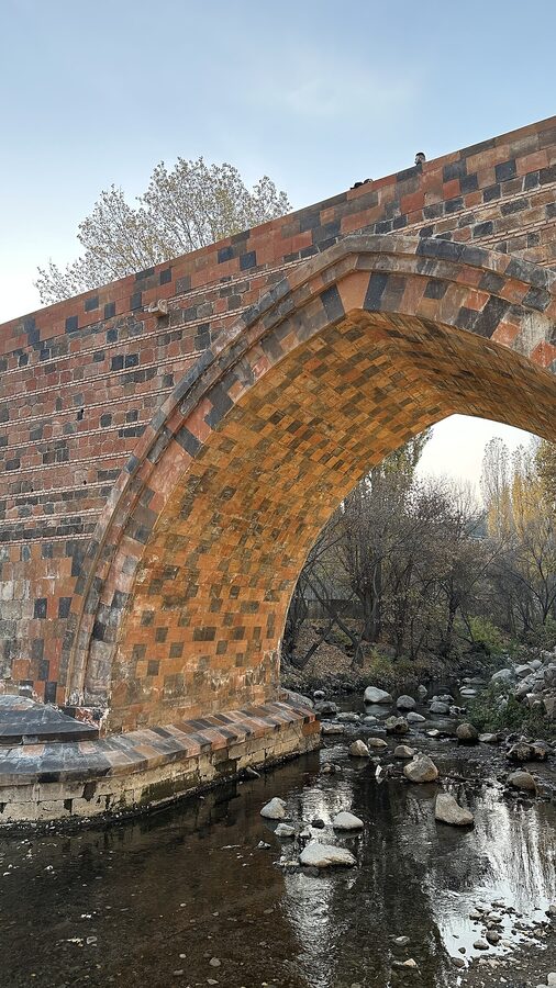
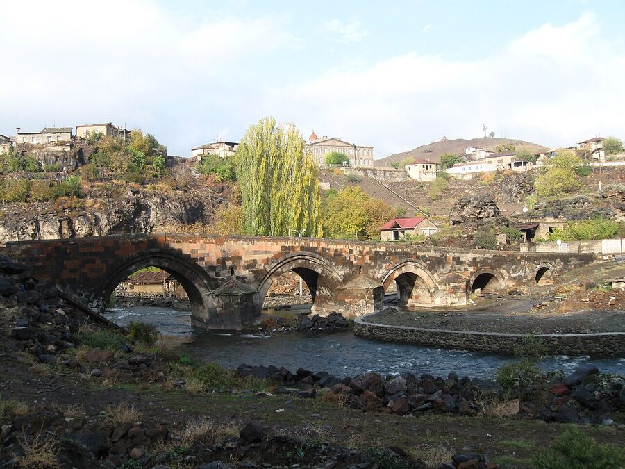
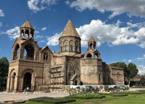
The headline bridge. Built in 1192 by Queen Vaneni in memory of her husband Abas, the last king of the small Kiurikian dynasty of Lori. It’s a single basalt arch, 18.6 metres across the Debed, with a stepped roadway that adapts to the lopsided terrain (the right bank is significantly higher than the left). Four worn lion sculptures sit at the corners of the parapet, badly weathered but still recognisable. The locals just call it “the Stone Bridge”.
It is also a UNESCO World Heritage Site, listed in 2000 alongside Sanahin Monastery and the nearby Haghpat Monastery. UNESCO inscription has not made anyone fix the foundations.
What’s actually there
You walk across it. That’s the experience. The bridge is pedestrian-only since the 1960s, when they finally stopped letting trucks of up to fourteen tons over a 12th-century arch. There’s no admission, no ticket booth, no signage of any quality. There’s a worn-down lion at each corner of the parapet, and you’ll miss two of them if no-one tells you they’re there. There’s also the original khachkar inscription that Vaneni left, but the actual stone has been moved up to Sanahin Monastery for protection, so what you see at the bridge is the place where it used to be.
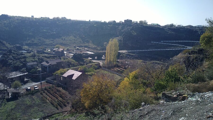
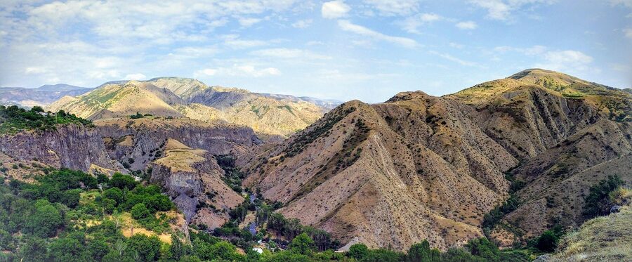
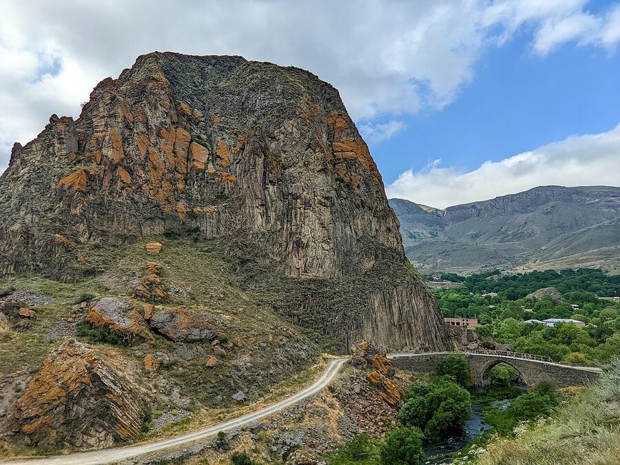
The old town of Alaverdi sits on the right bank, terraced up the gorge wall. The copper smelter chimney that dominates the view is from the Soviet period, when this was a mining hub. It’s mostly derelict now. The contrast is part of the place.
Getting there
Alaverdi is about 170 km north of Yerevan, around three hours by car. There’s no train service. Marshrutkas (shared minibuses) leave from Yerevan’s Kilikia bus station for Alaverdi a few times a day; the fare runs about 2,500 dram (~$6 USD) but the schedule is loose. A taxi for the day from Yerevan, with stops at Sanahin and Haghpat monasteries, runs 25,000–35,000 dram (~$60–85 USD) depending on how hard you negotiate.
Once in Alaverdi, the bridge is in the southern part of town. Anyone you ask will point you down. From the main square it’s about 800 m of switchback descent on foot, or two minutes by car. There’s no parking lot. People pull up on the verge.
Combine with
Most people pair it with Sanahin and Haghpat monasteries up the hill (both are part of the same UNESCO listing). If you’ve driven this far, you also want to factor in the Mikoyan Brothers Museum in Sanahin village, which honours the two Soviet-era Mikoyans (Anastas the Politburo member, Artem the MiG fighter co-designer). I find the museum more interesting than it sounds. You’ll need most of a day for the loop. The food in Alaverdi is roadside khorovats stands and not much else, which is a fair representation of the country’s grilling culture and worth a brief detour into our traditional Armenian food guide if you want to know what to order.
My take
Worth the trip. The drive up through the Debed canyon is scenic enough on its own, and the monastery-bridge combination is one of the most rewarding day trips out of Yerevan. Go on a weekday. The bridge gets short bursts of bus-tour traffic mid-morning; come early or after 4 pm and you’ll often have it to yourself.
The Red Bridge, Yerevan
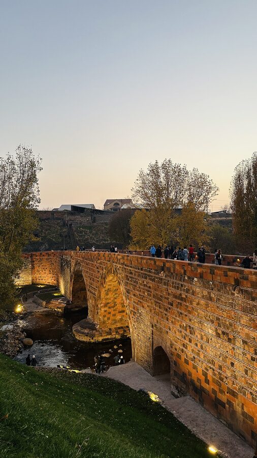
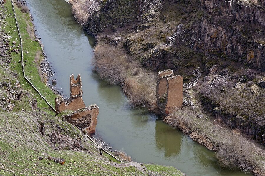
For a long time, the Red Bridge was the answer to the question “what’s the oldest thing in Yerevan still standing?” It’s named for the dark-red volcanic tuff in its masonry, the same stone the city is built from. It crosses the Hrazdan river a short distance below the old fortress site. The 12th-century origin claim shows up on most Armenian-source guides; structurally, what survives is the four-pointed-arch road bridge from 1679, restored in 1680 after an earthquake, and then again by Russian engineers in 1850.
Until the Victory Bridge opened in 1945, this is the bridge the Yerevan–Echmiadzin highway crossed. Caravans, marketgoers, pilgrims, all came in over its 87 metres. In the 1980s the northern arch was dismantled for what was meant to be a quick rebuild, and then the December 1988 Spitak earthquake redirected every available engineer in the country to Spitak and Gyumri. The Red Bridge sat half-disassembled for the next thirty-five years. Cars hurtled past on the Victory Bridge a few hundred metres downstream and most Yerevantsi forgot the Red Bridge was even there.
The reconstruction finally finished and the bridge reopened in 2025. The arches are restored. There’s parkland around it. The chamber that had collapsed inside one of the abutments is being turned into a small museum. It’s now an actual destination, not just a heap of stones.
How to find it
The bridge is in the Hrazdan gorge, off the western edge of Kentron district, near the foot of the cliff that the Yerevan fortress used to sit on. The closest landmark is the Yerevan Brandy Company (Ararat Brandy Factory) on the gorge’s eastern rim. From there, you walk down into the gorge (there’s a marked path) and the Red Bridge is roughly 600 m south, beneath the Victory Bridge, which carries the Admiral Isakov highway. Allow about 15 minutes from the brandy factory on foot. Free to visit; no opening hours; the parkland is nicer in afternoon light.
My take
Yerevan finally has a historic bridge worth showing visitors, and it’s a five-minute downhill from the brandy tasting at Ararat. Pair the two. If you’re already planning a Yerevan day around the Cascade and Republic Square, the Red Bridge slots in cleanly. Skip it only if you’re rationing time hard. The Sanahin bridge up north is structurally older and more atmospheric, and the Red Bridge will keep.

Ashtarak Bridge
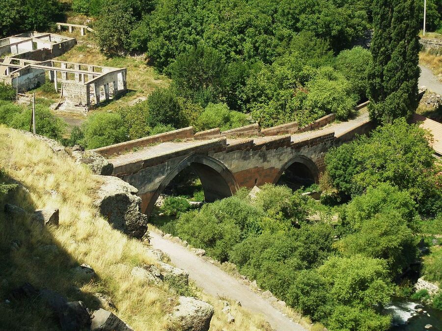
About 20 km northwest of Yerevan, on the road to Mt Aragats. Three masonry arches built in 1664, spanning the Kasagh river gorge that cuts the town of Ashtarak in two. Less famous than Sanahin but in some ways more useful, since this is the bridge you can walk across in twenty minutes from a Yerevan-bound marshrutka stop, no special trip required.
The Ashtarak gorge has half a dozen small churches dotted along its rim, three of them in walking distance of the bridge. Karmravor (the 7th-century single-naved chapel) is five minutes’ walk from the bridge’s southern approach and is genuinely one of the oldest structures still in continuous use in Armenia. The church and bridge make an obvious half-day combination from Yerevan.
Getting there
From Yerevan, marshrutkas to Ashtarak leave from Kilikia bus station every hour or so for 300 dram (~$0.70). Driving, take the M3 north and then the H19 turnoff into Ashtarak; there’s parking on the gorge’s south rim near Karmravor church. The bridge is at the bottom of the gorge; you walk down a short path. Allow about ten minutes each way on foot, more in summer if it’s hot.
My take
An easy yes if you’re going to Aragats, Amberd Fortress, or anywhere northwest of Yerevan, since you’re driving through Ashtarak anyway. Fifteen minutes of your day. As a standalone trip from Yerevan, it doesn’t quite earn the journey on its own. Pair it with Saghmosavank or Hovhannavank monasteries further up the gorge and you have a full afternoon.
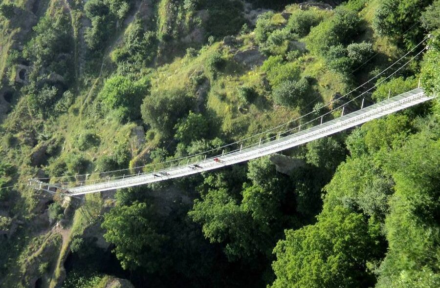
Khndzoresk Swinging Bridge
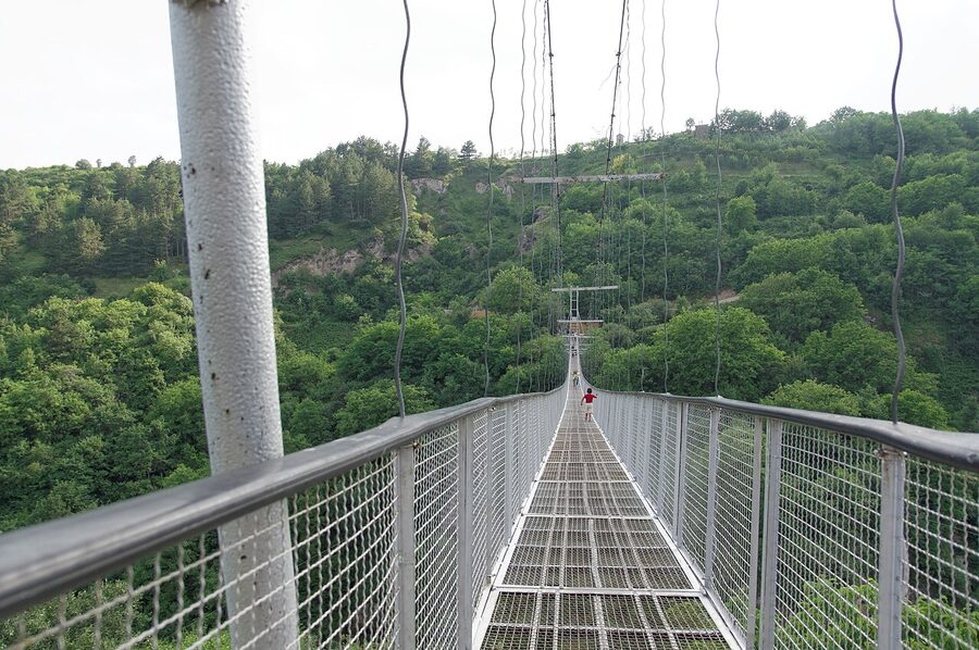
Yes, this one’s modern. The Khndzoresk Swinging Bridge opened in October 2012: a 160-metre steel suspension footbridge across the Khor Dzor gorge, 63 metres above the canyon floor. It earns its place on this list because of what it connects to: the abandoned cave village of Old Khndzoresk, where people lived in caves carved into the gorge walls until the 1950s, when the Soviet authorities relocated everyone to the modern village on the rim.
The bridge was built without any heavy equipment by villagers from the new Khndzoresk, using techniques that wouldn’t have looked unfamiliar to the medieval bridge builders three hours’ drive north. They wanted a way for visitors to reach the cave village from the modern village without doing the long zigzag down and back up. It worked. The bridge has become Khndzoresk’s calling card.
Getting there
Khndzoresk is in Syunik, the southern province, about 8 km from Goris. Goris itself is a 4-hour drive south of Yerevan on the M2 highway. Most people fold Khndzoresk into a Tatev day trip, since both are in the same area. From Goris, a taxi to the new Khndzoresk village runs 2,000–3,000 dram (~$5–7) one way; ask the driver to wait or arrange a return time, since taxi traffic in Khndzoresk is sparse. From the parking area in the new village, it’s a 15-minute walk down to the bridge approach. Closing the loop through the cave village and back up takes about 90 minutes for a moderately fit walker, longer in heat.
Free to cross. The bridge sways noticeably mid-span. That’s the point. If you genuinely don’t like heights, walk to the lookout at the new-village end and look across rather than crossing.
My take
The bridge is the gateway, not the whole experience. The cave village on the far side is what you came for. Wander it. You can climb into some of the dwellings, the old church of St Hripsime is still there at the foot of the gorge. As a single attraction the bridge would be a curiosity. As the entry to a 90-minute walk through an abandoned village, it’s worth the long drive south. Pair with Tatev Monastery and the Wings of Tatev cable car for one of the strongest day-loops out of Goris.
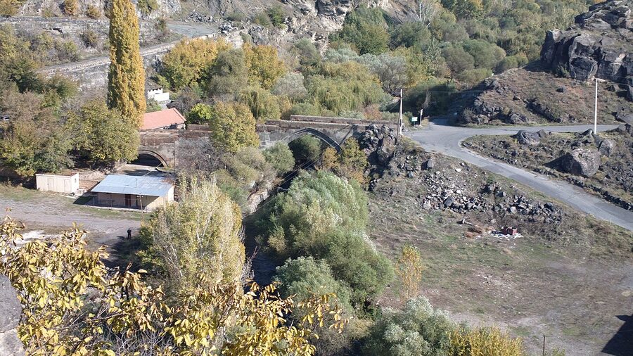
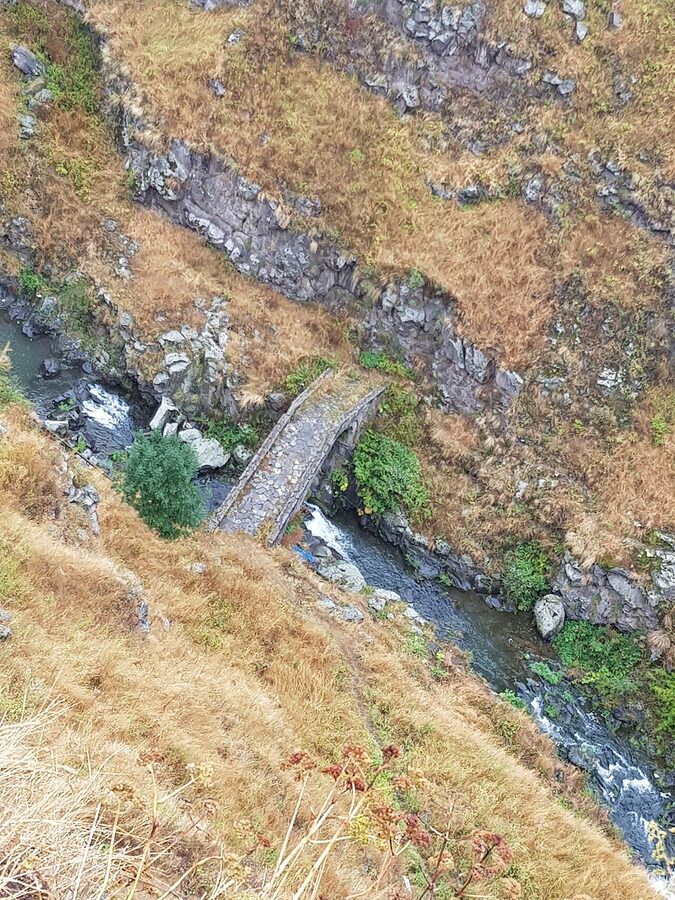
Lori Berd Bridge
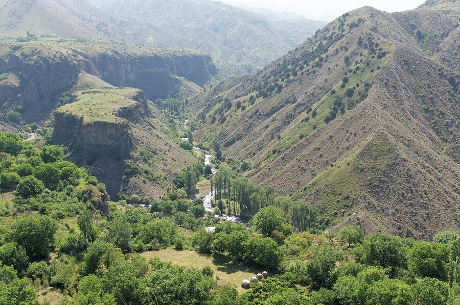
The bridge most people miss. Lori Berd was the fortified capital of the Kiurikian kingdom in the 11th century, built on a triangular plateau where the Dzoraget and Misjana rivers meet. The bridge is at the bottom of the gorge, not next to the fortress but a steep walk down from it. Single masonry arch, 11th century, partly ruined parapets, but the arch itself is intact and you can walk across.
This was the ancestral seat of Queen Vaneni’s husband Abas, the same family that built the Sanahin bridge a few decades later. The Kiurikians were a branch of the Bagratid dynasty, the medieval Armenian royal house, and Lori Berd was their last serious centre before the Mongols rolled through. The site was sacked in 1238 and never really recovered.
Getting there
Lori Berd is near Stepanavan in northern Armenia, about 130 km north of Yerevan. From the M3 highway, take the H21 east through Stepanavan and follow signs to “Lori Berd” or “Loriberd” for about 5 km on a road that goes from paved to gravel to track. Last 200 m to the fortress is on foot. The bridge requires another 10–15 minutes of careful descent into the gorge from the fortress on a sometimes-slippery path. Sturdy shoes; not for after rain.
My take
For people who already love this kind of thing. The fortress site itself is essentially open ruins. There’s no signage to speak of, no admission, you just walk it. The bridge in the gorge is a real find if you make the descent. Don’t bother if rain is forecast. Pair with Stepanavan town and the Dendropark (an arboretum founded in 1931 by a Polish forester) for a full day’s worth of obscure-but-rewarding northern Armenia.
Oshakan Bridge
Oshakan village is best known for the tomb of Mesrop Mashtots, the 5th-century monk who invented the Armenian alphabet. The bridge is a 30-second walk from Mashtots’s church, which means most visitors cross it without really seeing it.
Built 1706, five arches, three of them pointed in the late-medieval Armenian style. It still carries road traffic on the H19, light vehicles only now. The Kasagh river runs beneath it, the same river crossed by the older Ashtarak bridge 7 km downstream.
Getting there
Oshakan is 25 km from central Yerevan, off the H19 northwest. Marshrutkas from Kilikia bus station to Ashtarak pass through Oshakan; ask the driver to drop you at the Mashtots church (most know it). The bridge is two minutes’ walk from the church.
My take
Built into a much bigger trip. Few people drive out specifically for the Oshakan bridge, but if you’re in Oshakan for the alphabet pilgrimage (and most travellers eventually are), the bridge is a free five-minute add-on you’d otherwise miss. The combination is reasonable: alphabet, then bridge, then up the road to Mughni for the 14th-century church of St George.
The Ani Bridge: visible from the Armenian side, not crossable
The 13th-century Ani bridge crossed the Akhurian River from medieval Ani (the Armenian capital, now in eastern Turkey) to the territory that’s now the Republic of Armenia. The closed border now runs right down the river. From the Armenian side, near the village of Kharkov in Shirak province, you can stand on a marked viewing platform and look across at Ani’s ruins and the broken stones of the bridge approach.
In 2024 Armenia and Turkey signed an agreement to jointly restore the bridge. As of 2026 the work has not started; the politics are more complicated than the engineering. The agreement matters anyway because it’s the first time in over a hundred years that the two governments have cooperated on a built-heritage project across this border.

How to see it
From Gyumri (Armenia’s second city), drive west toward Khachkar Hill via the village of Kharkov; the marked Ani viewing platform is about 25 km west of Gyumri on a paved road that runs parallel to the border. Bring binoculars or a long lens. There’s a Border Guards checkpoint short of the platform; passport advisable, no photographs of the checkpoint itself. Free, no opening hours, deserted on weekdays. Ten minutes is enough to take it in.
My take
Go if you’re already in Gyumri. The platform is a sober place. Ani was one of the largest cities of medieval Eurasia, the seat of an independent Armenian kingdom, and seeing it across an unreachable river makes a stronger impression than seeing the ruins from the Turkish side as a regular tourist would. Skip if you’re rationing time hard. Gyumri itself, the country’s earthquake-rebuilt second city, has a lot to offer beyond the day at Ani.
Garni and the Azat bridge
An 11th-century single-arch bridge over the Azat river, near Garni village. The arch itself is largely lost; what remains are the abutments and a short section of the approach. Most visitors to Garni pass straight to the temple and Geghard monastery and never go down into the gorge. If you do, the bridge ruins are about 1.5 km along the gorge floor from the temple plateau.
The reason to walk it isn’t really the bridge. It’s the gorge itself, which is one of the more remarkable geological sites in Armenia. The basalt columns (“Symphony of the Stones”) form a wall of perfectly hexagonal pillars that look quarried but aren’t. The medieval bridge was a working part of the system that connected Garni village to the agricultural fields on the far bank.

Getting there
Garni village is 30 km east of Yerevan, around 45 minutes by car. The standard Garni–Geghard day trip from Yerevan covers both for around 20,000–25,000 dram (~$50–60 USD) by hired car. Marshrutkas to Garni leave from the Mercury Mall stop in Yerevan, 400 dram (~$1) each way; the schedule thins out after 4 pm. From Garni temple, you walk down the road into the gorge; it’s signposted “Symphony of the Stones” or “Քարերի սիմֆոնիա”. 4WDs and small farm vehicles run the dirt road for 1,500 dram one way if you don’t fancy the 1.5 km walk in summer heat.
My take
The bridge ruins are an add-on, not a destination. Go for the gorge and the temple. If you have time and curiosity, the walk along the Azat to the bridge site adds an hour and rewards you with quiet. You’ll likely have it to yourself, even on busy weekends when the temple plateau is full of buses. Bring water in summer; there’s no shade in the lower gorge.
Melik Tangi Bridge, Vorotnavan
1855, a single pointed arch over the Vorotan river in southern Syunik. Late by the standards of this list (almost everything else here is medieval), but it’s a working bridge in a quiet corner that most travellers never see. The reason to come is partly the bridge and mostly the walk to it, which goes past Vorotnavank, an 11th-century walled monastery on a cliff above the gorge, and offers some of the best views in Syunik.
Getting there
About 215 km southeast of Yerevan. The bridge sits between Sisian and Goris on the Vorotan, just off the M2. Most people pass within 4 km of it on a Yerevan–Tatev drive without realising. The turnoff is from the village of Vaghatin, then 6 km on a small paved road, then the last 1 km on foot or by careful 4WD. There is no signage in English. Ask in Sisian if you’re not driving with a guide.
My take
For repeat visitors. If this is your first trip to Armenia and you’re already trying to fit Tatev, Khndzoresk, Goris, and the Wings of Tatev cable car into a southern loop, you can skip this one without regret. If you’ve already done the obvious south circuit and want a quieter day in Syunik, this is exactly the kind of place that rewards the second-trip energy.
The bridges you can’t visit (right now)
Two bridges that turn up on every Armenian-language list, both unreachable in 2026:
The Karavaz bridges over the Araks river. Two related medieval spans (one 5th–7th century, one 12th–13th century, also called Khudaferin in Persian sources) at the Iranian border in what was the Kashatagh region of Artsakh. Eleven arches, 130 metres long, foundations possibly Achaemenid. The territory has been under Azerbaijani control since the 2020 war. Not visitable from Armenia.
The Hunot bridge near Shushi. Built 1720, 25 metres long, in the Hunot canyon near Shushi (Shusha in Azerbaijani). Also currently in territory under Azerbaijani control. The bridge itself was reportedly intact as of recent Azerbaijani publications, but not accessible to Armenian or independent visitors.
Both are listed here so you know what’s missing from any “complete” account of the historic bridges in this part of the world. They were among the most striking pre-modern bridges in the south Caucasus. They are not on the itinerary.
Practical notes for any of these trips
When to go
Late April to mid-October is the working window. Spring (May–June) is when the rivers are loudest and the bridges photograph best, especially Sanahin and Lori Berd, which sit deep in gorges and look most dramatic with high water. July–August is hot in the lower gorges; the Azat below Garni and the Hrazdan in Yerevan get into the high 30s°C. September–October has the colour, the cooler weather, and the apricots are gone but the pomegranates are coming in. November to March most of the gorge approaches are slippery or frozen; doable but harder, and the Lori roads can be impassable after snow.
Driving vs marshrutka
Sanahin, Ashtarak, Oshakan and Garni are all reachable by marshrutka if you’re patient. Lori Berd, Melik Tangi, and the Ani viewpoint really need a car or a hired driver. A licensed driver from Yerevan for a long day runs 30,000–40,000 dram (~$75–100 USD), more for southern province trips that involve overnighting in Goris or Sisian. Do not rent a car if you can avoid it. The gravel approaches and unmarked turnoffs make hired drivers more efficient than self-drive.
What to bring
Sturdy walking shoes for any of the gorge bridges. Carry water; the village shops stock the basics but you may not pass one between the parking spot and the bridge. A small pocketknife or multi-tool is useful for the cheese-and-bread roadside picnics that come with this kind of trip. Cash, in dram. Many of the small villages along these routes don’t have ATMs and few of the village shops accept cards. Yerevan banks change USD and EUR at fair rates; airport rates are noticeably worse.
Combining bridges with the rest of an Armenia trip
None of these bridges is a standalone reason to fly to Armenia. They become reasons to take the day trip you’d already be considering: Sanahin alongside the monasteries, Ashtarak with Aragats and the Mughni church, Khndzoresk with Tatev. If you’re spending three or four days in Yerevan, the Red Bridge is a 90-minute walk from the centre. If you’re already drawn to Armenian art and culture, the bridges sit naturally alongside other Yerevan stops like the Saryan House Museum and the city’s well-loved theatre scene for the days that the weather isn’t cooperating.
One last thing about Sanahin. After the May 2024 flood, the prime minister stood in front of cameras and pointed at the bridge as the example of how to build to last: high arch, narrow gorge, the kind of decisions a 12th-century engineer made because he knew the river. Then the inspection report came back and showed the right-side wall had been damaged after all. Both things are true. The bridge has stood for 832 years and is in trouble. If you want to see it the way I saw it, go now, while it’s still here, and stand on the right bank in the morning with the light coming in low. It earns the trip.
.jpg)
.jpg)
.jpg)
.jpg)
.jpg)